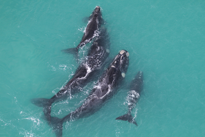
South Africa's coastline is a crucial home to the southern right whales, especially between Nature's Valley and Muizenberg. Over the past 55 years, researchers at the Mammal Research Institute (MRI) Whale Unit, University of Pretoria, have monitored the recovery of these whales through annual aerial surveys, documenting their impressive rebound from the brink of extinction due to commercial whaling.
Dr. Els Vermeulen, the Whale Unit’s research manager, emphasizes: “We now estimate a population of around 6,500 southern right whales in South African waters, growing at a rate of 6.5% per year.” This incredible recovery showcases the success of global conservation efforts, but new challenges are emerging as environmental changes impact these majestic creatures.
Key Insights
- Whale Population Growth: South Africa’s southern right whale population has grown to around 6,500, with a 6.5% annual increase.
- Satellite Tracking: Real-time data reveals whale migration routes across the Southern Ocean, showing changes in travel distances.
- Environmental Impact: A 23% drop in maternal body condition highlights the effect of climate change on feeding and reproduction.
- Aerial Survey Legacy: The 55-year aerial survey provides one of the longest datasets on any marine mammal, aiding in population studies.
Tracking Southern Right Whales: The South African Satellite Initiative
Starting October 1st, the Whale Unit will continue its groundbreaking satellite tagging program, deploying 12 more satellite transmitters on adult southern right whales in Walker Bay. This cutting-edge technology allows scientists to track the whales' movements as they migrate thousands of kilometres to their feeding grounds in the Southern Ocean.
Last year, 16 whales were tagged, and one of the transmitters is still active, showcasing the immense distances these whales travel. The real-time satellite tracking maps reveal fascinating migration patterns, available for the public to view on the MRI Whale Unit’s website.
"We've seen a dramatic shift in whale foraging strategies over the last few decades," says Vermeulen. "This change, combined with a 23% decrease in maternal body condition since the late 1980s, tells us that environmental factors in the Southern Ocean are impacting their feeding success and reproduction rates."
The Numbers Tell a Story of Recovery—and Struggle
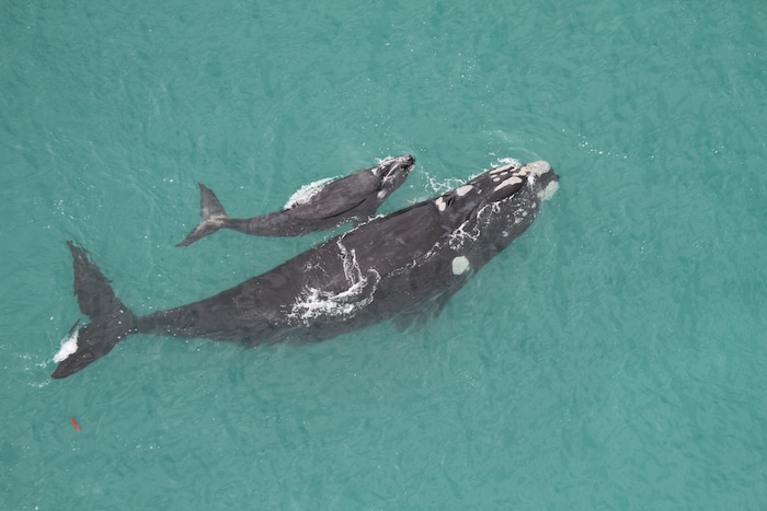
In the 2024 aerial survey, preliminary counts showed around 270 female southern right whales with calves between Hermanus and Witsand. These numbers are promising, closely matching the counts from previous years. However, fluctuations in annual reproductive output and maternal body condition suggest that the whales are feeling the strain of environmental changes, which may impact future population growth.
This 55-year-long dataset is one of the longest uninterrupted datasets on any marine mammal in the world, providing scientists with crucial insights into how these whales are responding to long-term environmental changes. By comparing modern satellite data with historical aerial survey data, researchers can now understand the challenges southern right whales face in their migratory and feeding habits.
Map showing tracks of all 26 adult southern right whales tagged in Walker Bay since 2019. This map can be seen in real-time on the MRI Website
Satellite Tags Reveal Migration and Feeding Patterns
Satellite tracking gives scientists a new perspective on southern right whales’ lives. These tags provide data on migration routes, dive depths, and even water temperatures in their feeding grounds. “The whales need to fatten up during their summer in the Southern Ocean so they can migrate back and give birth,” explains Vermeulen.
In recent years, tagged whales have revealed increasingly longer migrations as they search for food in response to climate change. Understanding these shifting patterns is critical to predicting future trends and ensuring the protection of their feeding grounds.
Understanding the Environmental Impact on Southern Right Whales
The satellite data confirms what researchers have suspected: southern right whales are being forced to travel further and feed less efficiently due to changing environmental conditions. This decrease in body condition not only impacts the health of the whales but also affects their reproductive success.
“The success of their migration and calving relies heavily on their ability to feed well in the Southern Ocean,” Vermeulen points out. “As their foraging grounds change, so too do their migration routes, reproductive output, and even survival rates.”
A Long History of Whale Research in South Africa
Since 1969, the annual aerial surveys have documented the steady recovery of southern right whales. These surveys involve photographing over 2,600 identifiable individuals using aerial photography, helping scientists track individual whales over decades. The unique callosity patterns on their heads serve as fingerprints, allowing researchers to compile sighting histories, map reproductive cycles, and understand long-term population trends.
Follow South Africa’s Whales in Real-Time: Satellite Tracking and Conservation
For the first time, the public can follow the movements of these whales in real-time through the MRI Whale Unit’s online platform. As the whales travel across vast oceans, this satellite data offers an unprecedented glimpse into the lives of these fascinating animals.
Dr. Vermeulen and her team will continue to provide updates throughout the survey and tagging process. To follow the latest developments, including satellite tracking maps and aerial survey results, visit their website or follow them on social media:
Postscript:
As the deployment of these tags is of a sensitive nature, we will be working with international expert scientists. These include Dr Alexandre Zerbini from the National Oceanic and Atmospheric Administration (NOAA), the University of Washington’s Cooperative Institute for Climate, Ocean and Ecosystem Studies (CICOES/UW), and the Marine Ecology and Telemetry Research (MarEcoTel). Dr Zerbini is furthermore global head of the Scientific Committee of the International Whaling Commission. Deployment of CTD tags runs in collaboration with Prof Mads-Peter Jorgenson from the Greenland Institute of Natural Resources and Prof Jonas Teilmann from Aarhus University.
The results of our tagging work are processed in conjunction with similar work around the Southern Hemisphere for a species-wide approach to understanding the effects of climate change on global southern right whale population growth. This is done under the umbrella of the Southern Right Whale Consortium, under the leadership of MRI Whale Unit’s manager Dr Els Vermeulen.
Funding for this work is provided by the Office of Naval Research (USA) and the South African Polar Research Infrastructure (SAPRI) to whom we are extremely grateful. We also thank the Windsor Hotel and Southern Right Charters for their support for our work.