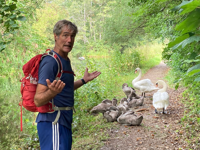
The monster reared up, beating its wings, hissing and skewering its serpentine neck towards us. In riposte, Fiona brandished a twig and I flapped my arms. But neither antic budged the large male swan guarding his brood and blocking the towpath. So we retreated through a hedge and followed the B4398 into Llanymynech. The wife and I were in Cymru, or Wales - the land of dragons, druids, double ls and Joneses - which we were traversing coast to coast, south to north, along its medieval border with England, through the so-called Welsh Marches.
We’d set out five days earlier from Sedbury, on the Severn Estuary. Behind us, across mudflats stood the mile-long Severn Bridge, constructed in the 1960s to connect England to Wales. Whereas ahead of us rose the start of an earth-clod embankment, built in the 780s and stretching 250km, to keep out the Welsh. Nearly 1200 years later, this mound inspired one of the UK’s first national trails, which formed the basis for our journey.
When we told friends we were doing Offa’s Dyke, they predictably sniggered - but they wouldn’t have dared do so in front of said king of Mercia, one of the dominant English realms during the Dark Ages. Having claimed the throne on the battlefield in 757, Offa ruled for nearly 40 years, a remarkable achievement in those turbulent times. A committed, if belligerent, Christian; he married Cynethryth; had prickly relations with the French; regularly fought the Welsh; subjugated several rival English kingdoms; and ruthlessly eliminated any relatives who might have challenged his only son succeeding him – which backfired when the son died six months later, effectively terminating Offa’s royal blood line.
After its strong first impression, the dyke submerged under housing estates outside Chepstow, a border town on the River Wye. Commanding the strategic river crossing was an imposing castle, built in 1067 by one of the three Marcher Lords, sent by William the Conqueror to crush Welsh resistance to Norman rule. In the course of our journey, we came across several of their edifices. And while these tyrants had their faults, they knew how to build castles, replete with deep moats, thick walls, neck-craning towers and airy ramparts.
From Chepstow, we traversed cliffs above the English riverbank, which were rich in local legend, lore and occasional facts. We balanced on Wintour’s Leap, from where a hapless Cavalier allegedly jumped 100m into the river to escape pursuing Roundheads. We clambered onto a rock dais overlooking Tintern Abbey, from where the Devil is said to have tempted austere Cistercian monks below (though they’d have needed sharp eyesight to see him). On Kymin Hill, we rested at the bombastic naval monument where Admiral Nelson picnicked with his mistress Lady Hamilton, plus her aged husband. And in Monmouth, we stood before the statue of King Henry V, the town’s royal son, who defeated the French at Agincourt thanks to the lethal accuracy of his Welsh archers - despite them suffering from dysentery and fighting with their pants down.
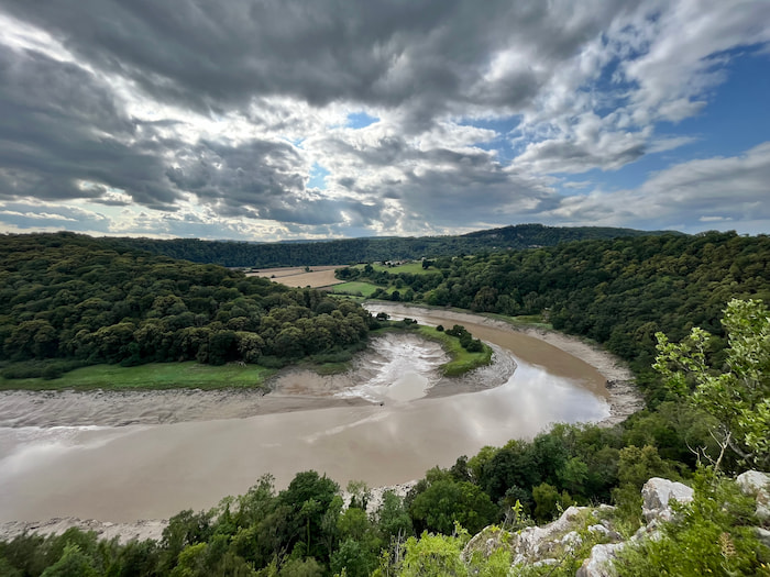
During our first few days, the meandering River Wye was a regular companion. Once renowned for its chubby salmon and described as ‘properly picturesque’, it inspired a Joseph Turner painting and William Wordsworth poem. In 2010, it was even voted Britain’s favourite river. Now, however, it was a turbid, chocolate brown, as if there’d been a leak from Willy Wonka’s factory - though it was actually due to fertiliser pollution.
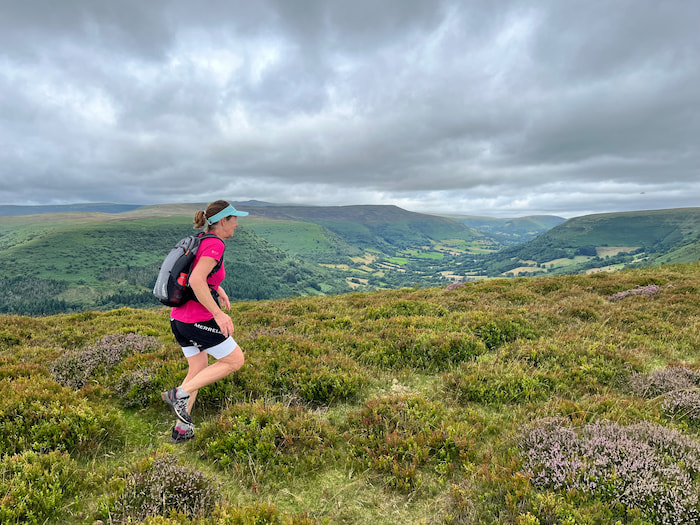
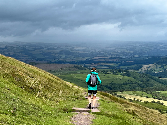
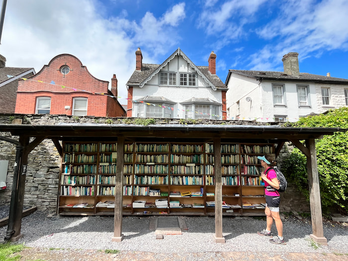
On our third day, after a stout climb from Pandy, we crossed the Black Mountains. Up on Hatterrall Ridge, the gently undulating heather seemed made for running - though as a supposed friend once noted, the only difference between me sprinting flat out and walking the dog is my facial expression. Along the way, we summited the trail’s highpoint, at 703m, but didn’t notice. A knee-buckling descent took us into Hay-on-Wye, the self-appointed book capital of the world, with over two dozen bookshops manned by tweedy bibliophiles. In the Age of Amazon, this might seem a contrarian piece of economic planning, but it made for a characterful town. The annual literary festival, dubbed by Bill Clinton as ‘the Woodstock of the mind’, had just finished; otherwise, we wouldn’t have found a room.
More by Matthew
The official length of Offa’s Dyke Path is 285km, but we covered slightly more, due to the need to divert off trail to find lodgings. Indeed, our nine-day itinerary was primarily dictated by available accommodation, which was often scarce. We stayed mainly in B&Bs, run by hospitable eccentrics; and we ate mainly in pubs invariably advertising for chefs, on a diet of scampi and chips. It was hardly a culinary tour, but then Wales’s contribution to global cuisine is cheese-on-toast. Characterful venues included the Skirrid Inn, Wales’s oldest, most haunted pub, at least according to its website. Convicted thieves were hanged in the stairwell and now haunted the bedrooms; while national hero Owain Glyndwr rallied his troops in the cobbled courtyard during his 15-year rebellion against English rule, before disappearing into the hills in 1415, supposedly ready to return in the country’s hour of need.
Our fourth day was the longest, from Hay to Knighton, which should have been 46km, but we added a couple more. Seduced by the springy turf of the Victorian horse racing track up on Hergest Ridge, we broke into a canter, failing to notice the one-mile course was circular till we’d lapped it twice. In our defence, we’d been glancing over our shoulders for the black dog of Hergest Court, which has prowled these hills since the 15th century, inspiring Arthur Conan Doyle’s ‘Hound of the Baskervilles.’
Almost the midway point on our journey, Knighton felt strangely subdued, as if it hadn’t fully recovered from being sacked by Glyndwr’s army. However, its Offa’s Dyke Centre was informative - even if only in admitting that historians can’t agree whether the dyke was built as a defensive fortification, border demarcation, customs barrier or egotistical folly.
Though the fifth day was our shortest at 24km, it felt much longer. Crossing the Shropshire Switchbacks, we were repeatedly grinding up, then careering down hills, setting off stampedes of livestock and skidding in dung. In compensation, between Llanfair Hill and Kerry Ridgeway, the dyke was at its best: standing nearly three metres high, augmented by a pronounced scarp and ditch on the Welsh side. And if an earth-clod mound sounds small beer compared to Hadrian’s Wall (built from stone by the Romans 650 years earlier, with regular forts and gateways), the Dark Ages hadn’t exactly been a boon time for structural engineers.
With the path flipflopping between England and Wales, we crossed the border over 20 times. In the absence of passport checks, we only knew when we’d entered Wales because the road signs were also in Cambrian – or Welsh – that melodic Celtic tongue comprehensible to less than one-fifth of the Welsh population. However, with one-third of Welsh residents now supporting independence from the UK, this trail might get more complicated in the future.
After the Shropshire Hills came two days through flatlands, which were dull on the eye, but gentle on our calves. And while navigating through the farm fields was hardly a matter of life and death, it was quite easy to cross to the wrong corner of a wheatfield, exit through the wrong kissing gate, emerge behind the wrong hedgerow, and disappear off the route map. Along the way, we found several plaques commemorating heroic Welsh victories over English invaders, which my history books didn’t corroborate.
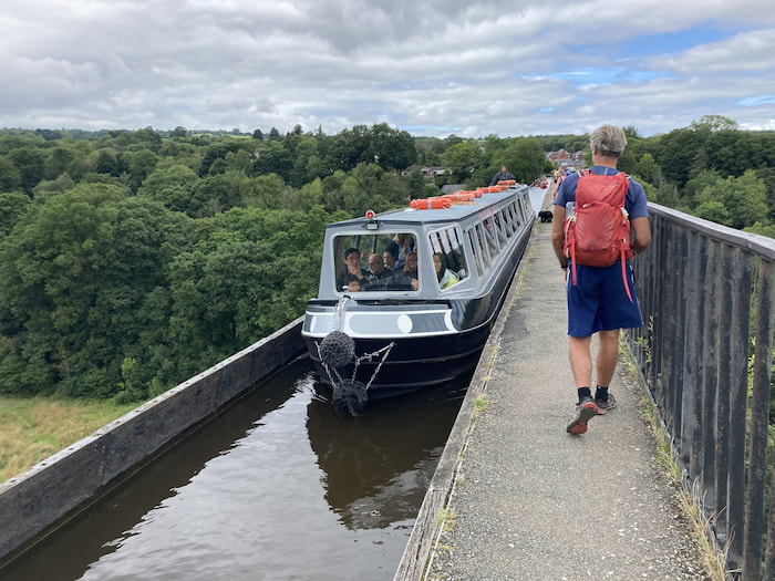
For variety and navigational ease, we occasionally followed canals, built in the late 18th century so Welsh mines could fuel the Industrial Revolution. The most spectacular from both an engineering and phonetic perspective was the Pontcysyllte Aqueduct, which carries the Llangollen Canal plus its narrow towpath over the River Dee, using 18 slender arches and minimal vowels. Some 40m high, over 300m long and less than 4m wide, it felt like crossing an Inca rope bridge, as narrowboats brushed past our knees.
Llangollen lay in a green vale, straddling white rapids and beneath limestone crags. In the town centre was a war memorial to its fallen sons (with Joneses topping the contribution) and a shop selling ‘oggies’. The culturally minded might recall Welsh actress Catherine Zeta-Jones chanting ‘Oggy? Oggy? Oggy? Oi! Oi! Oi!’, when accepting her 2003 Bafta award. But in case you don’t, Welsh miners’ wives would yell ‘Oggy?’ to enquire whether their husbands wanted pasties sent down the pit for lunch, with ‘Oi!’ being affirmative. We turned up just too late for the town’s annual Eisteddfod, celebrating Welsh music and poetry, purely by luck.
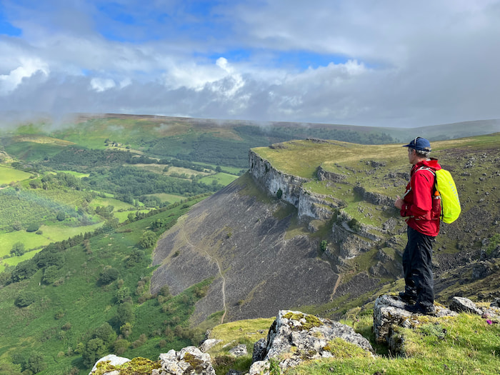
Beyond Llangollen, we ventured back into the mountains, stomping up to the atmospheric ruins of Castell Dinas Bran, an Iron Age fort, from which I half-expected Ordovician warriors to emerge. Then, having carelessly lost the path, we rashly scrambled up Trevor Crags, before beating across Eglwyseg Mountain to rejoin the trail at World’s End.
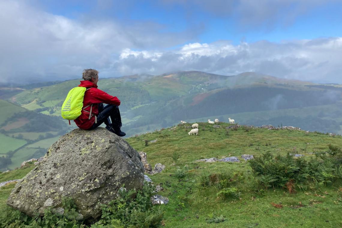
After Llandegla Forest came the Clwydian Range; a score of heather-carpeted, hump-backed moels (or hills), each around 500m high, and set out in a 30km line, like an over-zealous traffic calming project. Exposed on the ridge, buffeted by wind and rain, we eventually dropped down to shelter in Llanferres at the Druid Inn – the only reference we spotted on our journey to the mysterious Celtic priests who burned their human sacrifices alive inside Wicker Men, before they were exterminated by the Romans.
Our finale involved 37km, largely across hills, with a gale warning for good measure. While the rest of Europe suffered its hottest July on record, Wales was spared heatstroke, wildfires and prolonged sunshine – but then we hadn’t come here for a suntan. Our first waymark was the Clwydian Range highpoint, Moel Famau - meaning ‘bare mother’ in Welsh, which was a bit too Oedipal on a cold, wet morning. In swirling murk, we groped our way to the Jubilee Tower crowning its summit, from where on a good day you can see Snowdon and the Irish Sea. But it wasn’t that day, and we were relieved just to find our way back to the path.
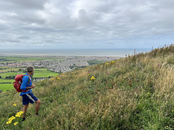
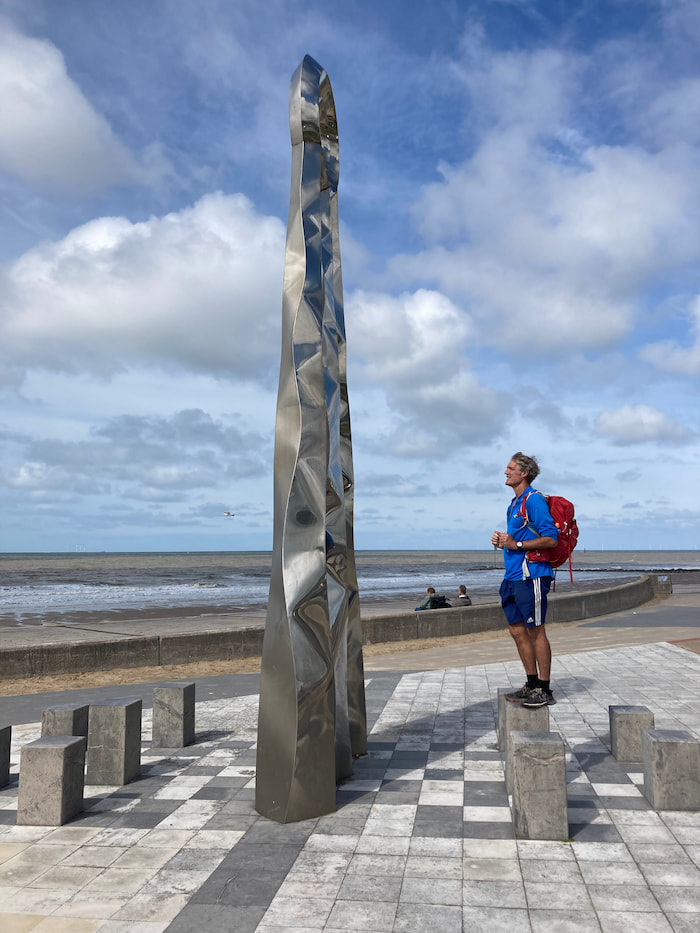
Doggedly following the ridgeline, we gratuitously tagged the remaining moels, exhilarated to be up amongst the racing clouds, with the hills to ourselves. As the humps relented in size and frequency, the gale did too, and we dropped into Prestatyn serenaded by gulls and warmed by some sunshine. Though this seaside resort’s heyday was back in the 1960s, it was still making an effort; with a lido, amusement arcade, crazy golf course, and shops selling plastic buckets and spades. Down on the seafront, watched by a few hardy holidaymakers, we posed by assorted monuments marking the terminus of Offa’s Dyke Path - a munificent, if ironic, legacy, for a fearsome warmonger. Then, we chased the outbound tide several hundred metres across shin-deep sand, till we could just about submerge in the receding surf.
