‘How strangely Fogo burns, amidst an ocean full of flying fishes.’ I was lured by the lyrics of this 16th-century madrigal. And that its composer, Thomas Weelkes, was sacked as Chichester Cathedral’s organist for blaspheming during a service and being drunk at said organ only increased Fogo’s draw.
At 2829m, Pico do Fogo - or Peak of Fire - is the highpoint of Cape Verde, an archipelago of ten diverse islands, 600km off Senegal. Discovered and settled by the Portuguese in the mid-15th century, it became independent in 1975, but retains close ties with its motherland, sharing an affection for good coffee, wine and Ronaldo. Though its official name changed over a decade ago to the Republic of Cabo Verde, the rebranding exercise largely went unnoticed.
While climbing Fogo won’t win you a Piolet d’Or, it shouldn’t be sneered at, with this hyperactive Strombolian having erupted over 30 times since people started counting. The historical sequence defied my extrapolative ability, but seemed about every 20 years. Given the most recent eruption was in 2014 and lasted 77 days, I calculated now might be a good time to chance it.
Before setting foot on fiery Fogo itself, however, my wife Fiona and I decided to explore some of ͨCape Verde’s other constituents. After a 4½-hour flight from Lisbon, we landed on Sao Vicente, the principal island in the Barlavento, or windward cluster. Though it was mid-November in the northern hemisphere, the temperature was over 30°C, and we suspected we’d been overcautious bringing beanies and down jackets.
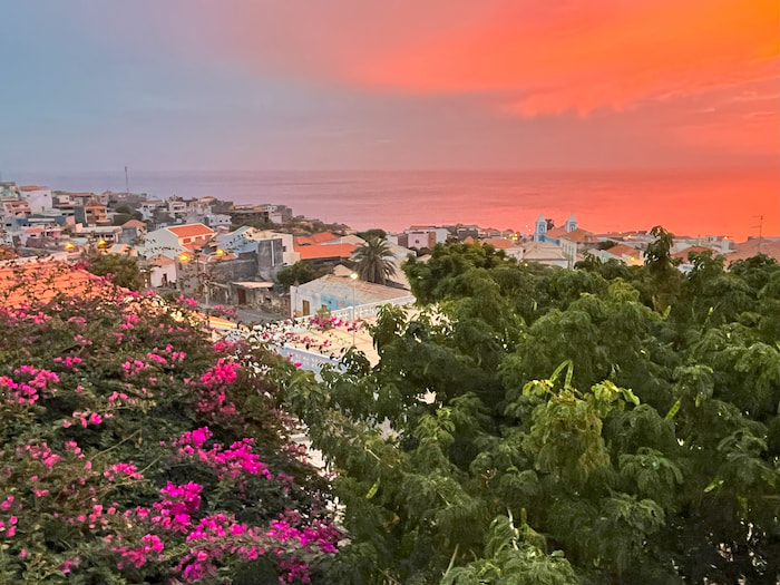
Mindelo, the island’s only settlement of note, had a relaxed, if slightly shabby air, with pastel-coloured colonial sobrados, vibrant wall murals, yawning street dogs, a few half-hearted grifters, and a tan sand beach. We checked into an elegant villa overlooking the halfmoon bay, to find the Prime Minister lunching on the terrace, without any visible airs or guns. Earlier, on our flight over, we’d inadvertently chatted to the Foreign Minister, who proffered his business card should we need any help. On first impressions, Cape Verde was a friendly, welcoming place, and we liked it. Later, over dinner, we learned from a rare local businessman that unemployment was rife, the economy was shot, the annual carnival in Mindelo was a blast, and Fogo wines were best.
Our arrival coincided with a transatlantic armada, and the marina was bustling with sail yachts and hearty crew. Initially a service station for passing vessels, Cape Verde was a key cog in the slave trade, but there didn’t seem any lingering historical grudges, with busts of former colonial officers still decorating gardens and plazas. Descended and blended from European settlers and West African slaves, Cape Verde’s population numbers half a million, with a much larger diaspora living in Europe and the United States.
While we didn’t hike up anything on Sao Vicente, we did venture down, diving a wreck in the bay. On the bumpy ride out in a rubber duck. I frowned at the racing waves. ‘We’re lucky, conditions are perfect’, announced our divemaster, just before I proposed aborting. When we dropped in, the surge was so strong my facemask was almost torn off, and my teeth were clamped so hard on the regulator I nearly ate it. The divemaster thought the vessel was sunk by a German U-boat during WW2, but was otherwise vague on its origins and mission. To be fair, the islanders could be excused for not caring too much about this ship’s provenance, given that during WW2 they were officially neutral, stricken with drought, and some 45,000 of them perished from hunger. And whatever its history, the wreck provided an exciting dive, just 15m down, coated in corals, swarming with shoals and attended by turtles.
More by Matthew
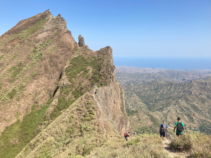
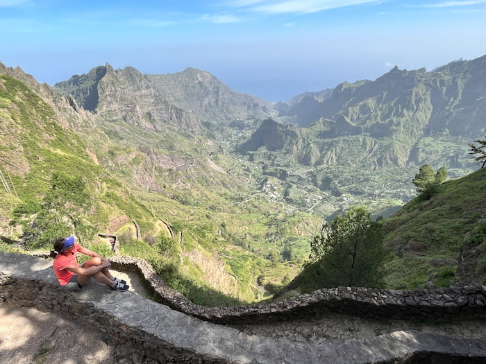
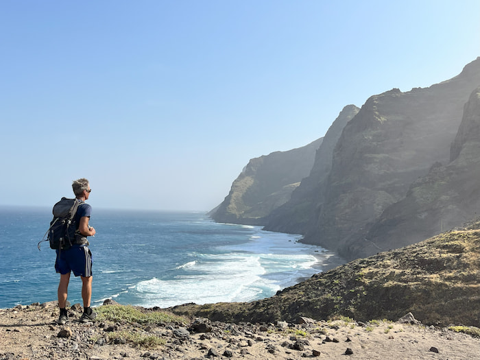
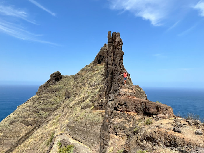
After a couple of days, we caught a ferry to the neighbouring island, Santo Antao, billed as Cape Verde’s hiking mecca. In the verdant central valleys, we tracked along terraces brimming with mangos, bananas and sugarcane, and suspiciously sipped the local ‘grogue’. On the wild north coast, we followed a roller coaster trail up steep ridges and down to the roiling surf, where Fiona had to be dissuaded from suicidal swims. And on the arid western plateau, we slogged up Tope de Corea, the country’s second highest peak at 1979m, to find a French group picnicking on the summit cairn.
On the hikes we did alone, the navigation was obvious - which was just as well, since my map was the size of a bedsheet and behaved like a parasail in the slightest breeze. Generally, however, we took local guides, who were fit, affable and highly knowledgeable. And while their official language was Portuguese and vernacular tongue a singsong Creole, they all spoke excellent English.
While on Santo Antao, we based ourselves in a small fishing harbour, Ponto do Sol, dining each evening on our pension’s narrow stoep, which we shared with a four-man band playing wistful songs by Cesaria Evora, the ‘queen of morna’ - who used to perform barefoot, with a fag in one hand and cognac in the other, and is posthumously commemorated on stamps, bank notes and an airport.
‘There was a grandeur in such scenery and to me the unspeakable pleasure of walking under a tropical sun on a wild and desert island’, noted a 23-year-old amateur botanist and geologist aboard HMS Beagle, when it moored at Santiago in January 1832, on the first stop of a five-year expedition to South America. While Charles Darwin’s name is more closely associated with the Galapagos, it was on Santiago in Cape Verde’s leeward isles, that he saw his first baobab, discovered a swamp warbler, named a gecko, and was intrigued by a geological unconformity on Quail Island, a tiny rock outcrop just off Praia – now the country’s capital city.
Whereas Santiago delighted the young Darwin, we found it rather busy and commercial. Initially, we stayed near Darwin’s geological oddity, Quail Island, on which a Chinese company was constructing a casino resort – though after eight years, they’d only managed to assemble a connecting bridge. We were happier in Santiago’s hinterland, stomping down the whimsically-named Gom Gom Valley and up the pointy Pico d’Antonia, which demanded more concentration than we’d anticipated the night before, when liberally quaffing Strela beers. On Santiago, we’d been supplemented by JB, a longstanding friend who used to live in Joburg, ride a Ducati, skydive and fight MMA, but now has a scooter, wife, three kids and pile in Surrey – which, no doubt, some will call progress. His arrival added fresh impetus to our trip, if only when it came to ordering more drinks.
From Santiago, we transferred to Fire Island, though this was easier said than done. Generally, I consider ferries the most satisfying mode of inter-island transport, but crossings here are often bumpy and delayed, prompting most of the islands to construct airports. What were scheduled as short hops by plane, however, invariably turned into odysseys, with our three inter-island flights averaging an airtime of 35 minutes, and delay of two hours.
The island of Fogo is a single, circular volcano bursting out of the Atlantic. The main settlement, Sao Filipe, clings to its western flank, some 50m above an inviting black sand beach - which we tried to visit, but the steps had dissolved in a landslide. Instead, we amused ourselves in the quirky museum, watching grainy footage of the 2014 eruption, projected onto a peeling wall. After a spectacular, if ominous, firework display, burning lava spewed out of a vent and advanced slowly, but relentlessly, across the caldera floor, consuming any homes in its path, while villagers desperately salvaged fixtures and fittings, right till the lava crossed their thresholds.
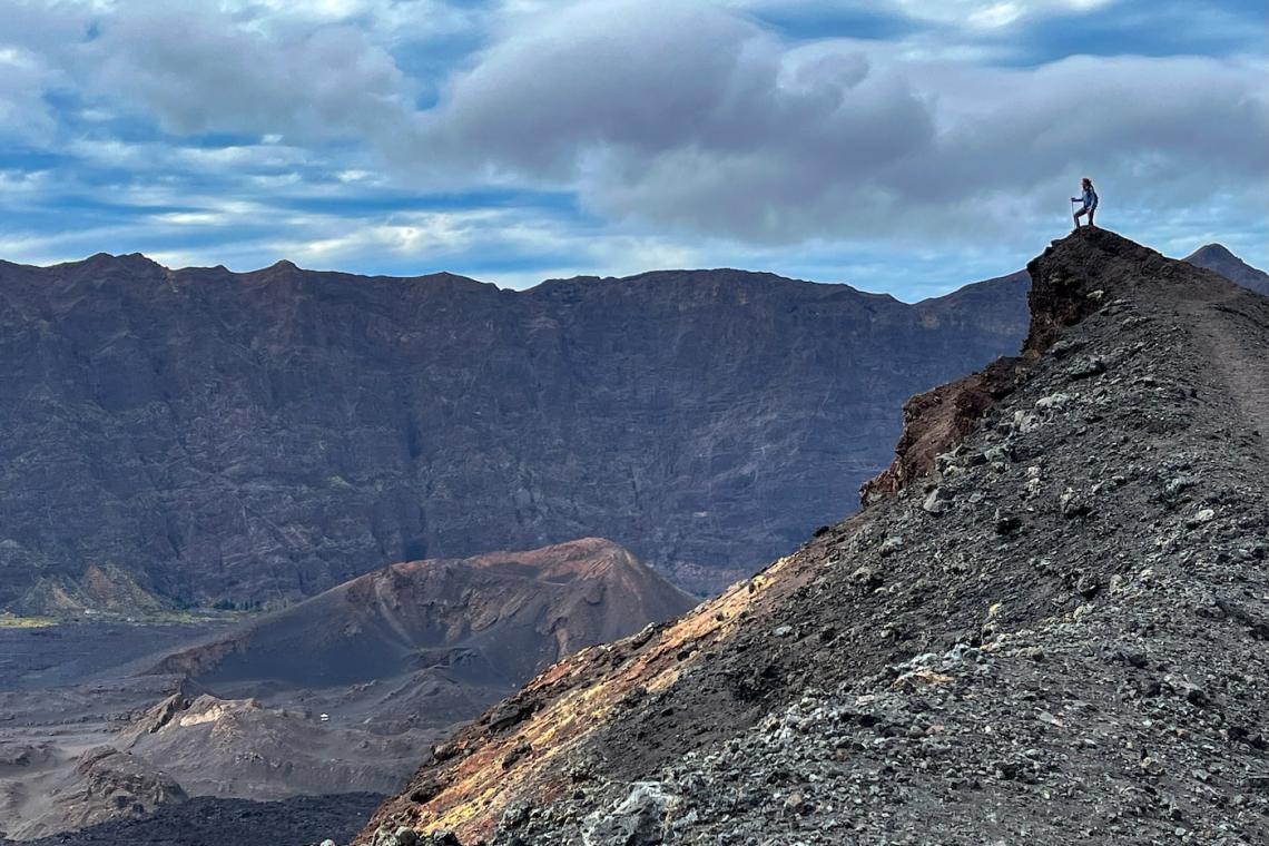
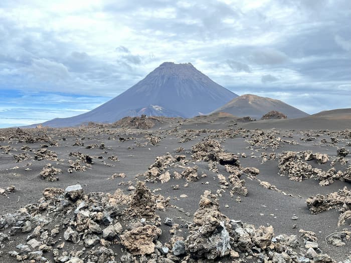
Though it was only an hour’s drive up to Cha das Caldeiras at 1600m, it felt like we’d landed on the Moon. Enclosed within the caldera, the plain was some 8km across, ringed by steep walls, and pitted with fissures and fumaroles. Forming its eastern perimeter and towering 1000m above us, was Fogo’s central cone. Everything was black or grey, but for a few hardy plants adding tiny splashes of colour. To perfect the apocalyptic vision, when we got out to take photos, the heavens abruptly burst open, drenching us before we made it back to the car.
Notwithstanding the periodic loss of their homes, over 500 people inhabit the caldera, in simple lava-block rondavels constructed on the graves of prior dwellings. After each eruption, they stubbornly return, rebuild and replant, attracted by the fertile soils. Coffee and wine cultivation were brought to Fogo in the 1870s by Count Armand de Montrond, who was banished from his native France after a duel, sired dozens of offspring with several partners, and died falling off his horse. His descendants are still recognisable by their curly golden hair and sparkling blue eyes. And in addition to coffee and wine production, some of his other mores survive in the caldera, with one local patriarch having fathered 47 children.
We stayed at a guesthouse in Cha das Caldeiras, erected atop its predecessor, though apparently before the lava had sufficiently cooled, providing our bedrooms with uncomfortable and uncontrollable underfloor heating. The following dawn, we set off for the summit, accompanied by Eurico, a part-time guide and farmer, who lived in the caldera along with some of his 19 siblings and scores of relatives. As we trooped through the village, he pointed out the ruins of their former homes.
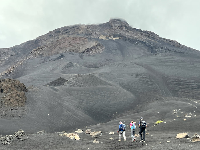
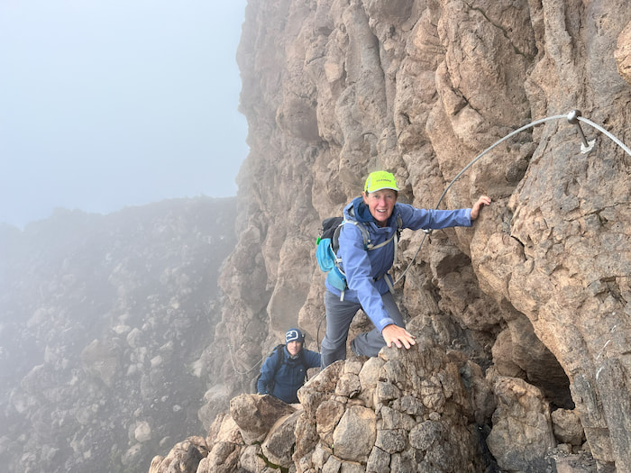
Just beyond the village, an erratically-marked trail zig-zagged up the cone’s northwest flank, progressing through powdery ash to lumps of coal to loose lava boulders. As the gradient steepened, our pace slowed, and JB’s wheeze became quite alarming. Daybreak had suggested hints of blue sky, but by the time we reached the cone’s upper echelons, the clouds had thickened and merged, engulfing us in swirling, damp murk. After 2½ hours, we realised we’d reached the crater lip, when we almost stepped off into void. From here, it was only a few hundred metres to the highest point, but this was the crux, clambering up a crumbly cliff pinned with a steel cable - which offered more reassurance before Eurico mentioned it was over a decade old.
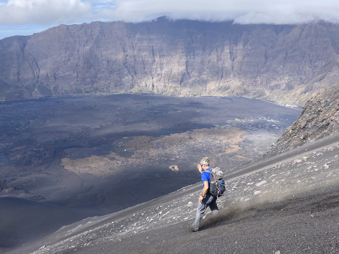
The roof of Cape Verde was an understated spot, with no national flag or patriot’s bust, just a pocket weather station. Allegedly, the views can be stupendous, but they weren’t for us. And though Eurico proposed waiting for the clouds to clear, he admitted this might take several days, so we declined. Our recompense was the descent. Slithering off the far side of the summit block via more cables, we ducked under the clouds and emerged on a slope of fine, powdery, ankle-deep ash, that we raced down flat out, reaching Cha das Caldeiras in just minutes. Anybody watching would have thought Fogo was about to explode – which it probably is. We duly celebrated our summit and survival with many modes of tuna plus a family of lobsters, washed down with Strela beers, Fogo wines and Santo Antao grogues.
Matthew Holt
20th January 2024
CAPE VERDE USEFUL TIPS
Cape Verde’s 10 islands are diverse in landscape, ambience and attractions. While the distances between them are relatively short, the actual journeys (by plane or ferry) can be lengthy - so unless you have plenty of time, it’s advisable to limit your trip to a handful. The most popular islands for hiking are Santo Antao, Fogo, Santiago and Sao Nicolau.
Cape Verde has four international airports: on Santiago, Sao Vicente, Sal and Boavista. Other than charter flights to Sal, most visitors transit through Lisbon. Most visitors do not require visas, but should obtain an online Electronic Travel Authorisation (EASE) prior to arrival.
Vista Verde Tours can arrange tailored hiking trips, including inter-island travel, accommodation, transfers and guides: vista-verde.com

