
Scaling Himalayan peaks over 8000 metres has become an increasingly common pursuit, so I decided to attempt the giants of Mauritius, a trio of mountains over 800 metres. My companions on this whimsy were two old friends, in every sense: JB, who prefers modest elevations, and Mandy Ramsden, who has an aversion to her office.
We assembled at Sir Seewoosagur Ramgoolam International Airport, named after the nation’s ‘founding father’, who became Prime Minister on independence in 1968 (and while it might seem a mouthful, a president on neighbouring Madagascar boasted 22 vowels in his name)
Before independence, this small isle changed hands several times. Initially spotted by Arab merchants in the 10th century, it was rediscovered by Portuguese mariners over 500 years later, who used it as a pitstop, stocking it with cattle, pigs and, inadvertently, rats. It was first settled by the Dutch in the 17th century, who named it after Prince Maurice of Orange, but found the cyclones and rats too bothersome. Once the Dutch had departed, the French came in 1715, renaming it Ile de France, importing slaves, cultivating sugar cane, and using it as a base to plunder British shipping - until 1810, when Britain got fed up and invaded. While the Brits changed its name back to Mauritius, abolished slavery (in 1835), imported Indians (to replace the freed slaves), and ruled for 158 years, the island has retained a more francophone feel - though fortunately they drive on the left-hand side of the road.
To stretch our legs and acclimatise, we joined throngs of locals taking evening constitutionals up Signal Hill, ignoring a sign declaring the Health Trail closed due to rockfall. Continuing along the ridge, we scrambled onto Quoin Bluff overlooking the capital and principal harbour, Port Louis, on the west coast. Inland to our east, was a semi-circle of spires forming the Moka Range, including the island’s second and third highest peaks.
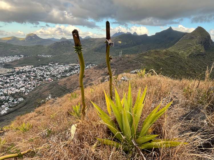
Mauritius erupted from the ocean as one big volcano, before the caldera eroded to leave five distinct ranges, which a more perceptive visitor, Charles Darwin - who spent 11 days here in 1836 whilst on his round-the-world voyage aboard HMS Beagle - noted as being ‘jagged by their sharpest points’.
Of the island’s 1.2 million residents, two-thirds are of Indian descent, one quarter trace their lineage back to African slaves, and the majority commute in and out of Port Louis, as we discovered driving back to our hotel.
Whereas Darwin explored the island on an Indian elephant, we’d more mundanely hired a Korean car, which stuttered up the B103 into the Black River Gorges National Park, in the southwest highlands. As a name, Piton de la Petit Rivière Noire (Peak of the Small Black River) hardly sets the pulse racing, but as the nation’s highest point at 828 metres, it was obviously top of our list.
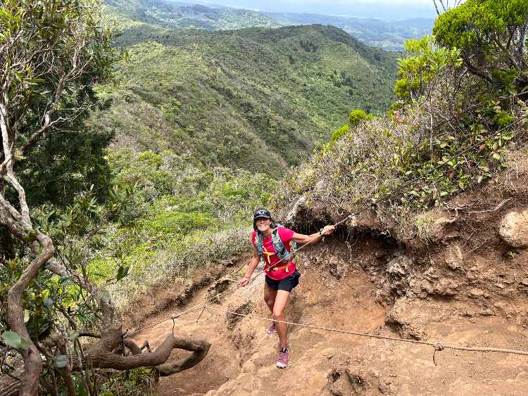
From the parking lot to the summit was only four kilometres and 150 net vertical metres, but via an undulating trail, and after half an hour we’d barely regained the elevation of the car. The path wound under a dense green canopy, with exposed roots to keep our eyes on our toes, and low-hanging boughs to clout us while we did. An hour in, we reached an open, muddy runnel, with a cat’s cradle of frayed ropes suspended from a tree. This was Mauritius’s own version of the Hillary Step, and possibly what the latter will look like given a few more decades of global warming.
From the small summit clearing, we could survey most of this pear-shaped island, some 65 kms in length by 45 kms at its fattest. Whereas Darwin noted that half the island was still in a wild, untamed state, that proportion is now significantly less. The Black River Gorges National Park was created in 1994 to protect endemic flora and fauna, but unfortunately came far too late for the island’s posthumously loved dodo, a large, flightless bird that disappeared into the pot nearly two centuries before Darwin formulated his Theory of Natural Selection.
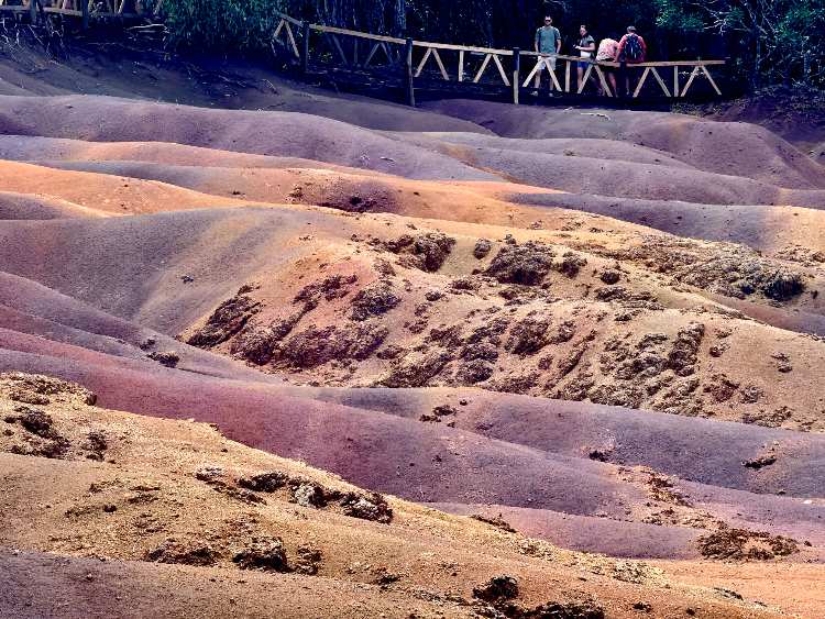
On the park boundary, we called in at Chamarel to view the impressive 100-metre-high cascade and exposed palette of coloured earths that never mingle, though I had to squint to discern seven distinct hues, except in jars for sale in the tourist shop. We also paid our respects to the giant tortoises, which can live for 150 years and might have watched much of the island’s history unfold, but for the fact they were brought from the Seychelles, since Mauritian giant tortoises went the way of the dodo. Watching these prehistoric creatures pad ponderously about their pen, I reckoned Aesop’s hare must have been particularly dozy.
With afternoon clouds brewing, we set off for Le Pouce, the third highest peak at 812 metres, so named because it looks like a thumb. We had come in October, statistically one of the driest months, between the typically breezy winter and humid summer. As it was, most days followed a similar pattern of bright mornings, mid-afternoon clouds, clear sunsets and cool evenings – at least until we started relying on this. Meanwhile, the three weather apps we consulted offered differing forecasts, which were unanimously wrong.
It was simple enough to find the trailhead, thanks to Le Pouce Road, which terminated beneath the peak’s southern flank at Roselyn Cottage. Beyond here, navigation was a little more uncertain, with colour-coded signs offering a quartet of routes, from which we blindly chose La Classique, hoping it went to the top.
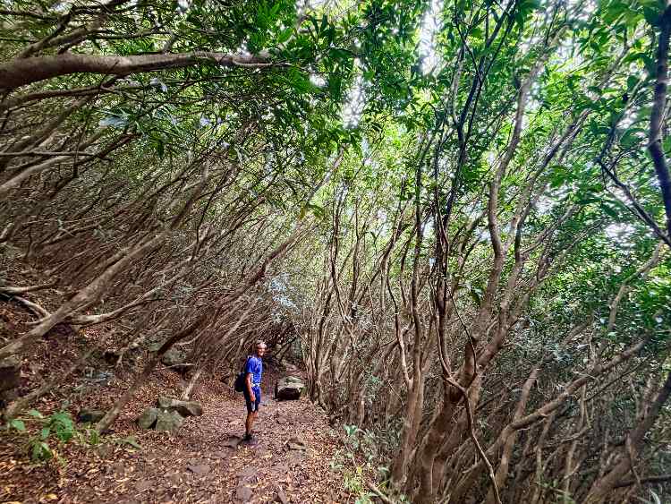
A stony path led through a forest of rose apple trees, leaning in to form a tunnel. Then, switchbacks climbed to a plateau, where we vaguely bashed towards the peak through head-high thickets of strawberry guava. And the finale up the right-hand ridge required hands and concentration, till we emerged on the small summit after an hour.
On making the first known ascent, on May Day 1836, Darwin remarked that Le Pouce provided ‘an excellent view over this great mass of volcanic matter’. My gaze was rather concentrated on a surreal spire three kilometres east, with a bulbous summit block perched on a slender neck. This was Pieter Both, the outstanding peak on our list.
We were staying at a boutique hotel in Black River on the west coast, and as base camp’s go, it wasn’t so bad. At breakfast, before setting out, we watched surf break over the reef. In the late afternoon, back from hiking, we bathed in the calm sea and rehydrated on Phoenix beers. At golden hour, we quaffed cocktails as the orange sun slipped below the horizon. And over candlelit dinners, honeymoon couples stole bemused glances at our threesome.
At 820 metres, Pieter Both was the second highest peak of our trio, but most technical by far. Even its name was more ominous, referencing the first Governor General of the Dutch East Indies who in 1614 was shipwrecked off Flic-en-Flac and drowned. Whereas the route used to involve an airy scramble assisted by staples and ladders, these were removed over a decade ago for obscure motives, turning the ascent into a bold solo or roped climb. We opted for the latter and, not having brought a rope, teamed up with Krish Hardowar, a local guide.
We planned for an alpine start to beat the heat, but one of our team slept in; then our navigator got confused, and it was 7.30 am before we finally found La Laura, a small hamlet at 400 metres, from where we set out on foot. It was a hard slog lugging ropes and climbing gear up a vegetated ravine, and we were soon drenched in sweat and ruing our belated departure. After an hour’s grunting, we broke out of the gully and traversed across to a shoulder, where we downed packs and contemplated the remaining task ahead. It looked improbable, with a thinning ridge rising steeply about 60 metres to a precariously balanced, giant boulder.
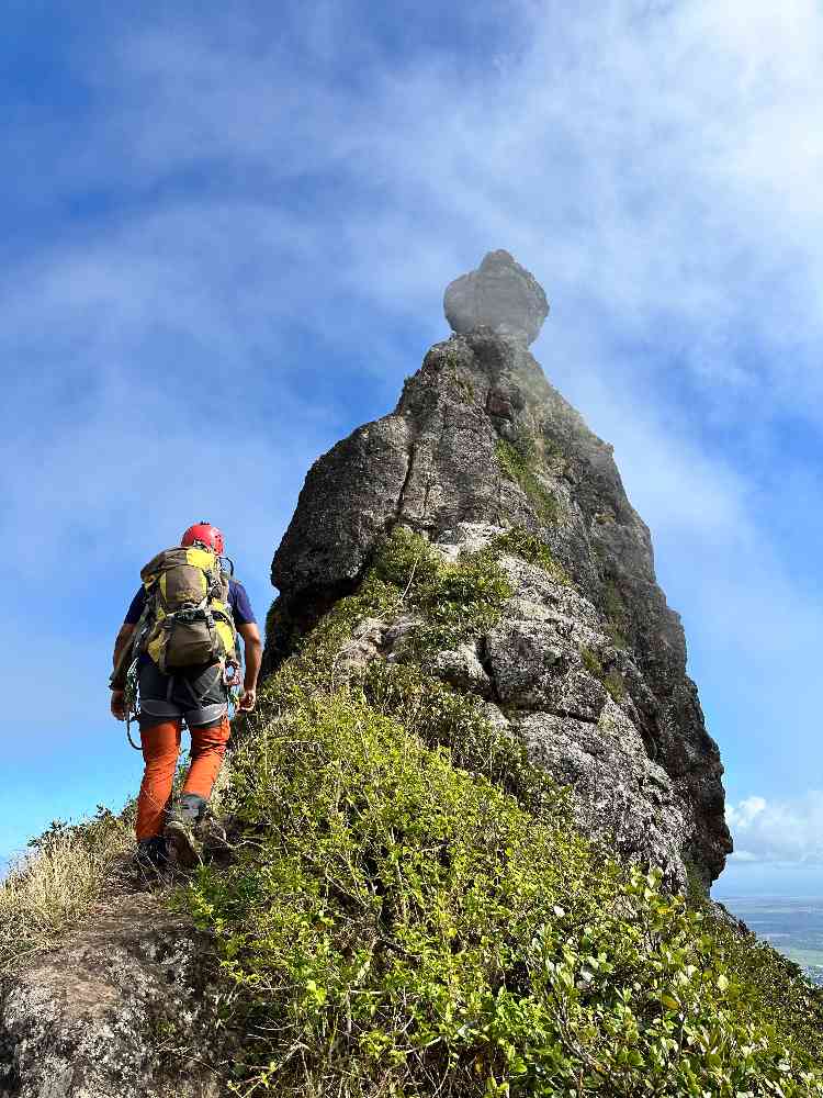
Geology aside, according to local lore, this block is a milkman who was turned to stone by fairies whom he chanced upon dancing. And according to yet more local lore, Mauritius will sink into the sea should this block ever fall off - which Krish casually predicted could happen anytime soon, spurring us to get a move on.
With Krish leading on belay, we followed one by one. In fact, the ridge was mostly easy-going, but for some 10 metres of awkward moves that had me grateful for the rope. On reaching the peak’s throat, we found that, although the summit block had looked like a separate monolith, it was actually sculpted by erosion. There were some metal rungs banged into it, but these unhelpfully started above head height, while the rock beneath was undercut. So, we clipped a climbing étrier into the lowest rung and took turns to gracelessly swing and spin on the free-hanging nylon ladder, till we could grab solid metal and clamber to the top.
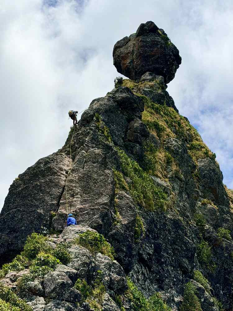
The first ascent of Pieter Both is a matter of national contention. In 1790, a Frenchman, Claude Pellé, claimed to have summited alone, but his account was subsequently dismissed by the British when they arrived on the island. Instead, they claimed the inaugural summit was made in 1832 by four British officers, aided by 25 African and Indian porters carrying a collapsible ladder, musket, ropes, rockets, smoked salmon, wine, brandy and cigars. Without wishing to take sides, the British expedition sounded more my style. By the time we’d abseiled, slithered and stumbled down to the car, we’d been out over five hours and were ready for celebratory beers.
We weren’t fixated solely on giants, also venturing up some of the island’s smaller peaks, including Lion Mountain, Corps de Guard, and the imaginatively named Trois Mamelles, or Three Nipples - which were all worthwhile two-to-three-hour outings, offering interesting scrambling and panoramic views.
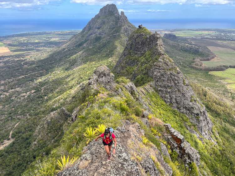
‘Mauritius was made first, and then heaven, and heaven was copied after Mauritius’, wrote the clearly enamoured American author Mark Twain, who visited the island in 1896. Driving around scruffy villages away from the tourist enclaves, I thought angels deserved better, and the locals seemed similarly minded. A few days into our trip, protests over a lack of municipal water turned nasty, especially after police shot dead a bystander. Thereafter, roadblocks, marauding gangs and an 8.30 pm curfew confined us during evenings to our hotel bar.
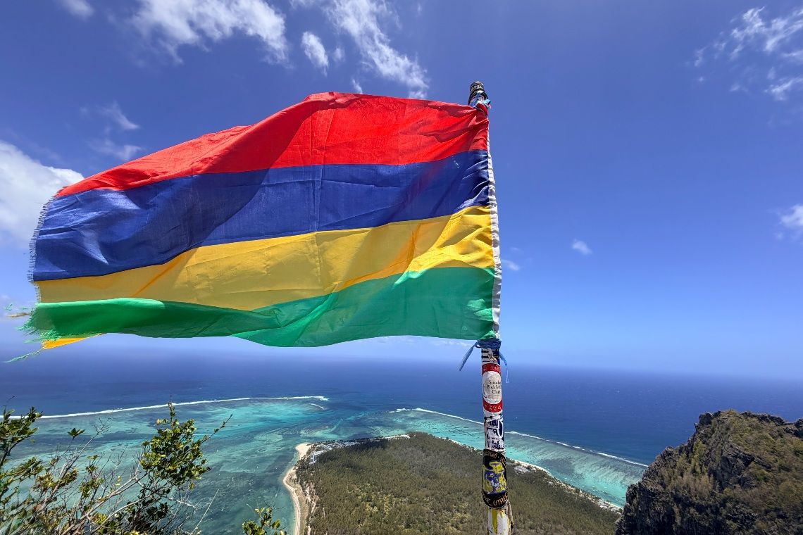
For our swansong, we hiked up Le Morne Brabant, a 556 metre, black basalt monolith on the island’s southwest tip. Notwithstanding a sign warning of ‘dangerous climbing’, this was by far the busiest hike we did, with over a hundred out on the trail - which started near a garden commemorating the island’s African slaves.
The peak was named after the Brabant, a Dutch ship which ran aground in December 1783, with ‘morne’ meaning ‘sorrowful’ in French. Coincidentally, however, the mountain top served as a sanctuary for runaway slaves, or maroons, who hid in its caves. Seeing colonial officials heading up the peak, some 300 maroons leapt to their deaths rather than return to captivity. According to local poet Sedley Richard Assonne, ‘There were hundreds of them, but my people the maroons chose the kiss of death over the chains of slavery.’ To add a bitter twist to the knife, this was in February 1835, and the officials were coming to tell them slavery had just been abolished.
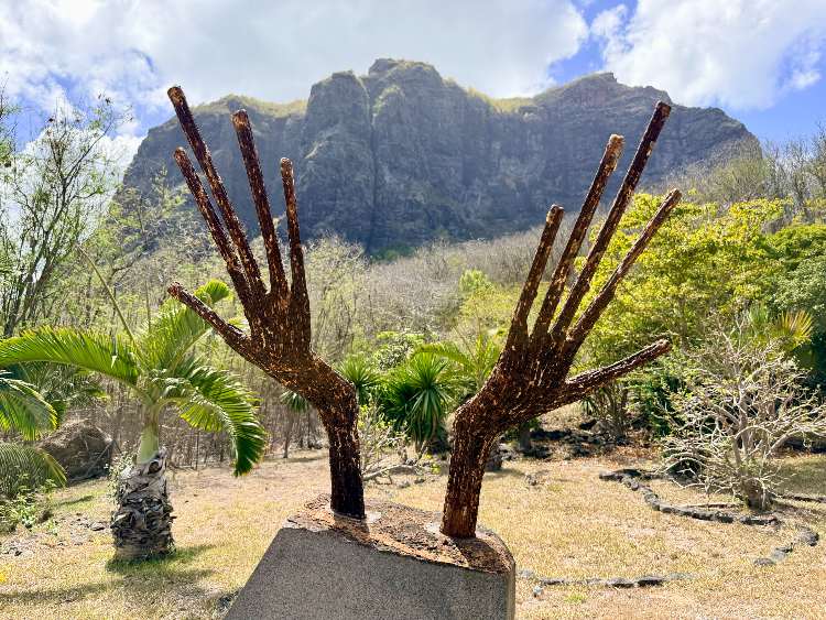
The ‘dangerous climbing’ involved some enjoyable scrambling up a dry water course to a rock platform bearing a large metal cross and flagpole. The actual summit was still 50 metres higher, but fortunately out of bounds, since reaching it looked consequential. Though Mandy and JB had spent the last few days bemoaning their imminent return to corporate bondage, neither were inclined to jump.
On the way up, I kept my eyes peeled for Trocheta boutoniana, the island’s floral emblem, which grows three metres tall with large, bright red petals and is endemic to this peak, but I didn’t see any. Once on top, I peered out to sea for the famed underwater waterfall, an optical illusion caused by a sharp subsea drop-off and roiling sand, but I couldn’t spot it. Nevertheless, the views across the spangled turquoise ocean were spectacular. After a week in Mauritius, the island didn’t quite match my notion of heaven, but the hiking was certainly worth coming for.
TOP TIP: Vertical World offers guided climbs of Pieter Both from Euro 95 pp: verticalworldltd.com

