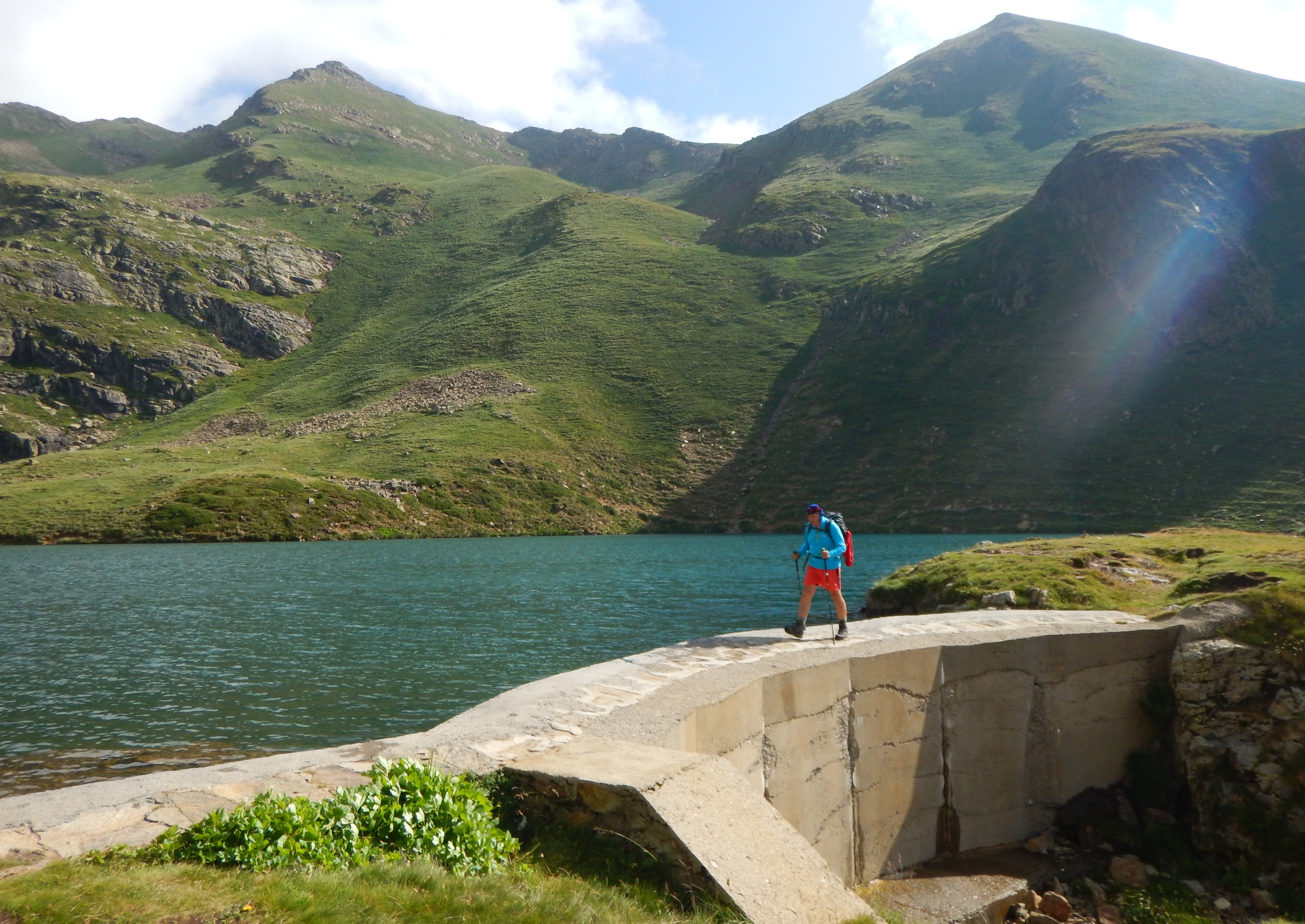
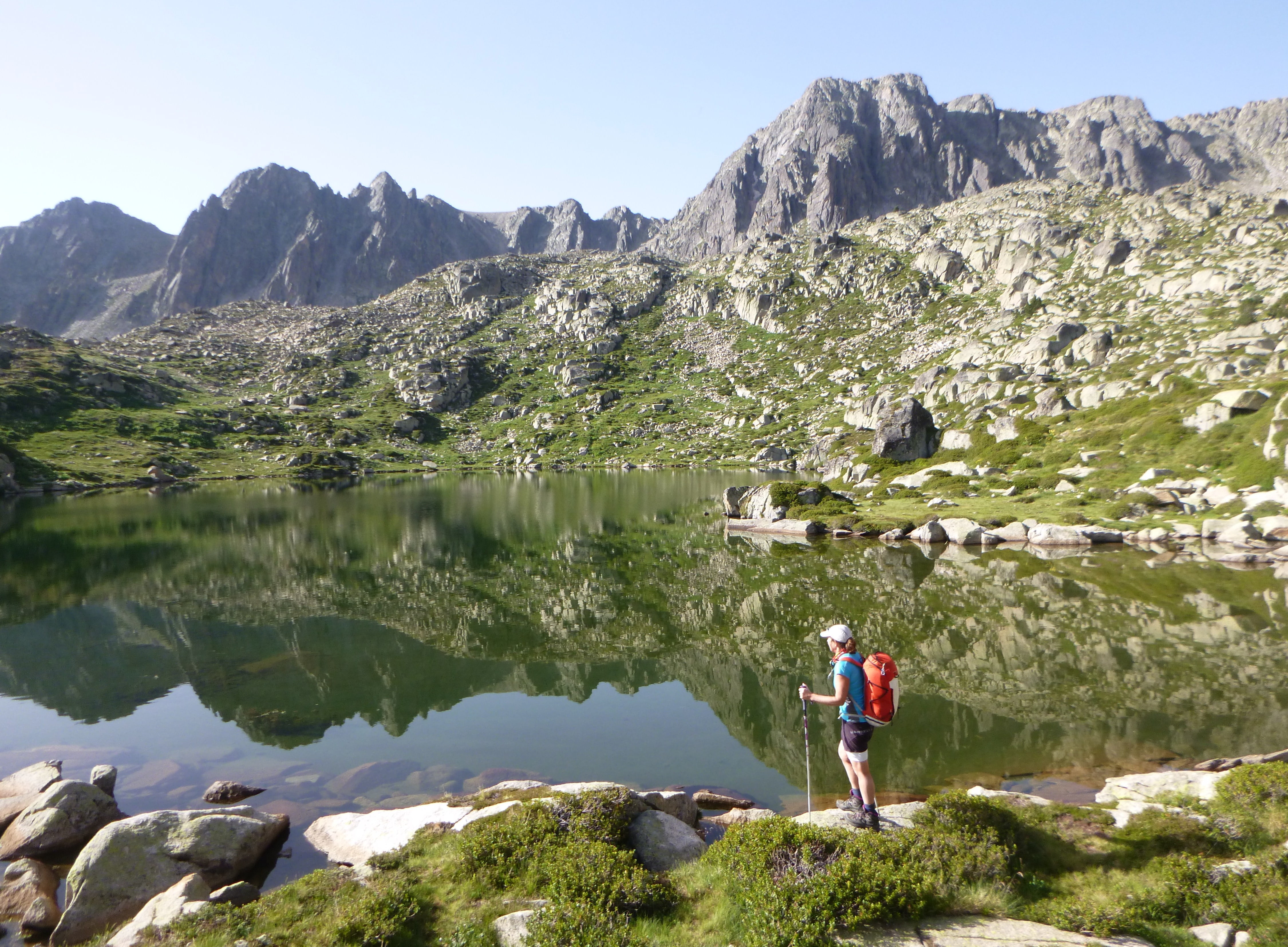
We undertook Andorra’s signature hiking trail in the Pyrenees, the Coronallacs - a circular, five-day stomp that takes in four-manned refuges, 16 lakes, 92km and, more pertinently, 6900m of ups and downs.
Fiona and I weren’t here to shop, however, but to undertake Andorra’s signature hiking trail, the Coronallacs - a circular, five-day stomp that takes in four-manned refuges, 16 lakes, 92km and, more pertinently, 6900m of ups and downs. We’d brought along an old college friend, Beesley, who spoke Spanish and French, only to discover Andorra’s official language is Catalan. He did, however, know some tax exiles in Escaldes, who entertained us bibulously.
The trail started (and finished) at the small A-frame tourist office in Escaldes, where we stepped over a party of Spanish hikers slumped on the pavement, boots and socks off, rubbing their feet, who delighted in telling us it was the hardest thing they’d ever done.
Notwithstanding a tardy start, we weren’t too concerned, with only 13km to the first refuge. Initially, the trail ambled beside the Madrui River, on a cobbled path that led past old shepherd huts. As we got higher, the forest thinned, till we entered more typical alpine terrain, and typical dark clouds started welling up.
Despite being at 2488m and only accessible by foot, skis or helicopter, L’Illa Refuge clearly had aspirations. A futuristic steel, stone and glass design, it had a chicken coop more salubrious than most alpine huts. Several hikers were already ensconced inside, including a large party from Barcelona, who pointedly told us they were Catalonian; seven Basque trail-runners, who emphasised they were Spanish; and an elderly couple who spoke only Catalan, with whom we communicated in sign language. There was also a Dutch woman traversing the Pyrenees solo, who spilled a glass of red wine over our only route map.
The next morning, we rose at 6.30am. There was no need for an alarm, for hikers were leaping with alacrity from bunks. In an apparent architectural oversight, there were only two working toilets servicing 50 guests, and desperate queues formed as parties scrambled to hit the trail. Subsequent days followed a similar routine and we generally got underway around 7.30am, depending on our position in the queue. Each day involved several calf-straining hauls up to cols above 2500m, followed by knee-pounding descents back down to the meadows. Of the trail’s 92km, about 3km was flat.
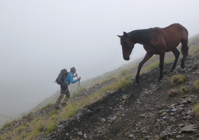
While we didn’t spot any wild boars or mouflons, we regularly came upon herds of horses, grazing high in the mountains, bells jangling round their necks - and we enjoyed stopping to scratch their foreheads. It seemed the perfect equine existence, till we discovered they were being reared for horsemeat.
In the afternoon, we would quicken our step in an unseemly race for that night’s refuge, with late arrivals condemned to the most dangerous beds. At the Juclà Refuge, where we stayed on the second night, the top bunks were three metres off the ground and accessed by a thin, rickety ladder. I sympathised with the elderly Catalan couple who stumbled in last, if not sufficiently to swap bunks.
The other major prompt to our pace was the weather, with Andorra renowned for summer thunderstorms. On the third day, we reached the Sorteny Refuge just as the heavens unleashed a Biblical torrent, causing us to shudder on behalf of any hikers still out there. Sure enough, the Barcelonans arrived at dusk, drenched, bedraggled and shorn of several members, who’d abandoned the venture.
The sustained grind whittled down most groups and, on that third day, we lost Beesley. As we paused for a break on the Coms de Jan, after a particularly cartilage- crunching descent, the sight of the tar road just several hundred metres below was too much of a temptation and - before we could restrain him - he fled, discovering a speed and agility hitherto lacking.
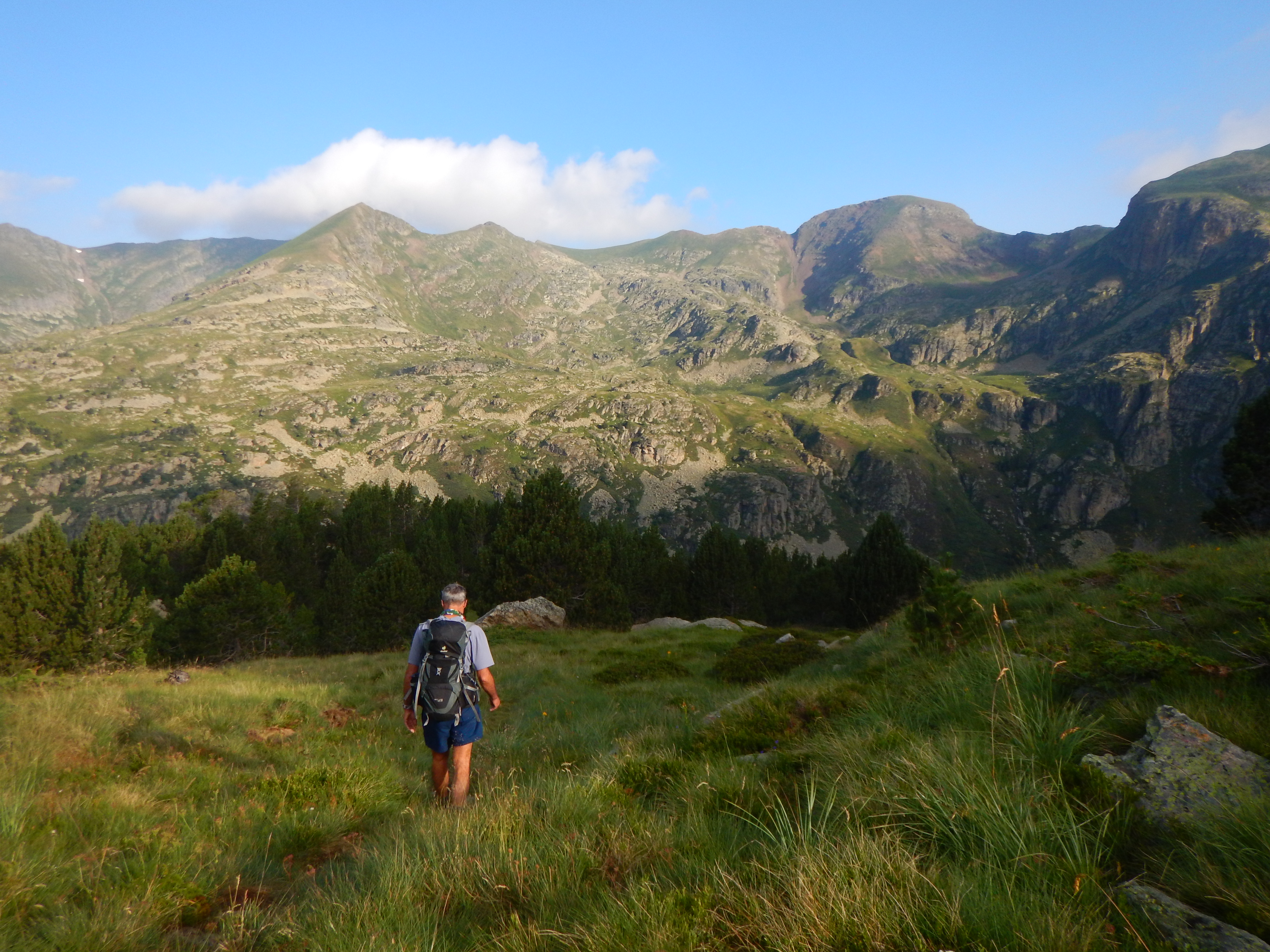
The trail’s crux was the fourth day, between the Sorteny and Comapedrosa huts, involving some 20km over high mountain passes. To complicate matters, we awoke in a sea of thick cloud. Nonetheless, we resolutely started the steep ascent up the Clot del Cavall, as the drizzle thickened to slanting rainMore by Matthew
Andorra hosts more hiking trails than roads; indeed, the mountains are crisscrossed with them. Sometimes this proved an unhelpful distraction, as on the previous day, when we’d been confused by a spaghetti junction of paths and spent an hour plodding up the wrong hill. But now it was our salvation. With thunder bellowing around us, we turned tail, dropped back into the valley and plotted a lower course to the Comapedrosa Refuge, arriving at the same time as the Barcelonans, who’d caught the bus round.
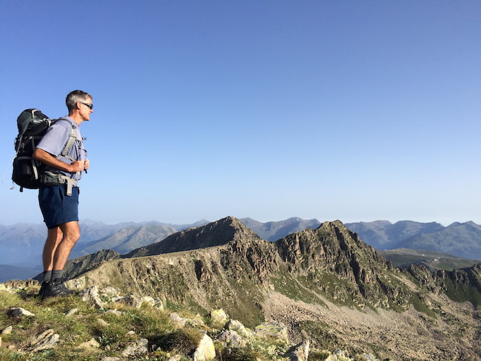
The next morning, we gratuitously ventured up Pic de Coma Pedrosa – Andorra’s highest point at 2943m. In swirling pea-green fog, we gingerly picked our way from one route marker to the next, till we found the summit beacon and a tableau displaying panoramic views into both France and Spain, though we could barely see five metres.
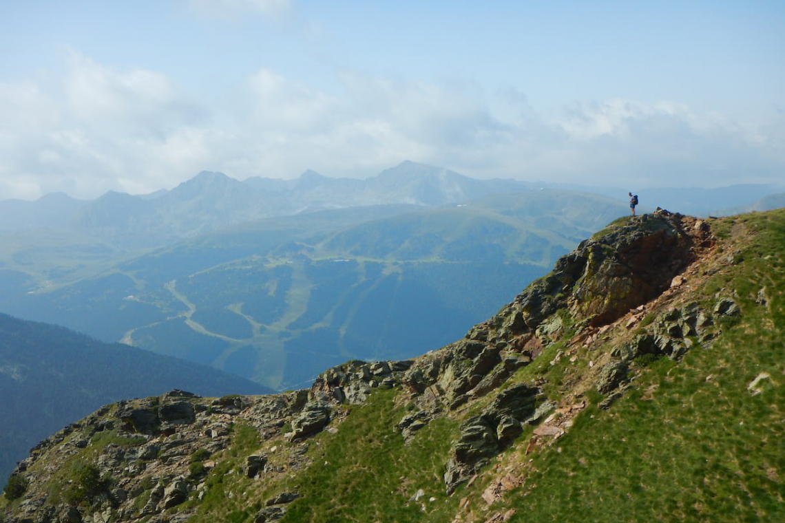
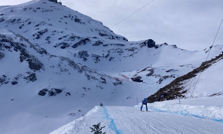
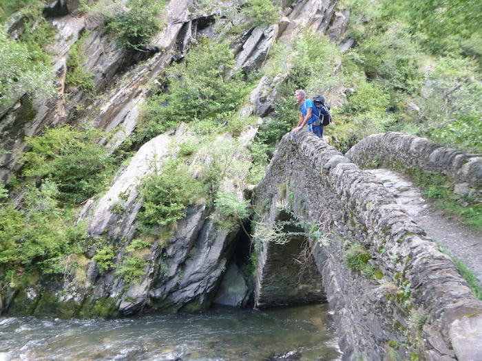
The final leg took us over Portella de Sanfonts, above snowless pistes and motionless chairlifts. Leaving the mountains, we dropped down through tobacco fields, over old stone bridges and along riverbanks to the tourist office in Escaldes, where we bumped into the Barcelonans and Catalans collecting their certificates. The pretty young blonde in the office even awarded one to Beesley, who’d come to collect us, despite my objections. Then, we headed into town, feeling ready for some duty-free drinks and tax-free shopping.


Shop for a cause
Shop on amazon.com | amazon.co.uk