Fiona McIntosh, author of Table Mountain Activity Guide and Hike Cape Town identifies three of her favourite hiking trails in Table Mountain National Park.
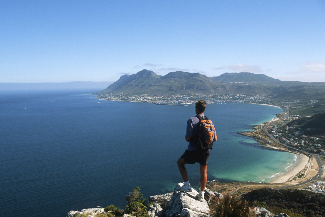
Capetonians are spoilt for choice when it comes to hiking trails. A network of paths criss-crosses the mountainous spine of the Cape Peninsula, taking walkers through exquisite fynbos, indigenous forest and to dramatic rocky viewpoints, while easy coastal tracks lead to golden beaches, rock pools and whale watching viewpoints. Much of the Peninsula is protected as part of the Table Mountain National Park, one of the hotspots of the Cape Floral Region World Heritage Site, with over 2 200 floral species, more than 90 of which are endemic. So even if you’re a seasoned hiker, you’ll never tire of hiking on Table Mountain.
Here are some of the trails less trodden.
Corridor Ravine
This lovely trail is one of my favourite hikes on Table Mountain, one of the New7Wonders of Nature. Very varied, it’s also one of the more gradual ascents, taking you right to the end of the Pipe Track, through a lovely shady section of indigenous forest before contouring around beneath the dramatic orange cliffs on its way to the Back Table.
Getting there
The easiest approach is from the trailhead on Theresa Avenue (opposite Sea Star Rocks Hotel). Follow the concrete road up the hill through magnificent stands of tree pincushions (Leucospermum conocarpodendron subsp conocarpodendron - a subspecies largely confined to the 12 Apostles at that altitude) alive with brightly coloured sunbirds, long-tailed Cape Sugarbirds and Red-winged Starlings, to where it joins the Pipe Track. (Alternatively park at Kloof Nek and walk along the Pipe Track. This will add half an hour each way to your route.)
Trail description
The concrete road ends at towering stone pines. From there continue up a rocky path that leads past the ruins of a stone break-pressure tank and a signpost indicating the path up Woody Ravine – your descent route.
A series of steep manmade steps, alongside the now-exposed pipe, takes you round Cairn Buttress and up into Slangolie Ravine. High above the path (and inaccessible) is an outlet from a disused tunnel through the mountain. Opened in 1891 and named after Sir John Woodhead, the then mayor of Cape Town, it fed water from the top of Table Mountain, via the Pipe Track, to the Molteno Reservoir in the city.
Scramble over the streambed and up through a steep, but lovely section of indigenous forest. Once out of the forest the trail hugs sheer sandstone cliffs as it follows a shale band past Slangolie Cave (just above the path and a good stop for a break) and round Slangolie Buttress, offering stunning views along the 12 Apostles. The path then takes a direct line up Corridor Ravine. It’s steep and a bit loose at the top, but will only take half an hour. This section burnt in October 2017 and the spring flowers, particularly the striking purple watsonia (Watsonia borbonica), are still impressive.
Turn left at the top and follow the Spine of the 12 Apostles Path, which is flanked by restios and, in spring, striking green and yellow conebushes. Just before you summit of the next ridge (Slangolie Buttress) you’ll see a faint path off on the left, marked by a cairn. This leads to Tranquillity Cracks, a veritable maze of deep, cool cracks in which yellowwoods reach for the sky - the perfect spot for a picnic.
A short, steep but easy scramble takes you down to the head of Slangolie Ravine. After a short climb up the other side it’s easy going from here to the top of Woody Ravine. Keep your eyes open for shy klipspringer, and in summer, Blue Disas (Disa graminifolia) as you go.
Heading home
Most hikers will probably complete the loop by descending the very popular Kasteelspoort path. But this is the road less trodden, so if your knees are up to a steep descent, and you’re comfortable with a bit of easy scrambling, rather head down Woody Ravine to rejoin the Pipe Track.
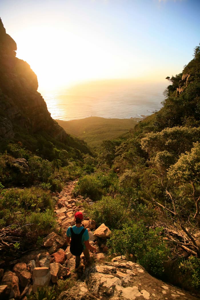
The largely shaded and very direct route (it should take about an hour to the bottom of the ravine) is a good descent option from the Back Table, particularly on a hot or windy day but it’s definitely not a walk in the park. Short but steep rock bands, uneven boulders, slimy slabs and slippery tree roots mean that you need to concentrate on your footing, particularly if the path is wet. Keep both hands free to support yourself on surrounding trees and boulders!
The path starts off in fynbos, before dropping - via some rock slabs and short scrambles in the narrow upper section of the ravine – into indigenous forest alive with birds. For much of the way the trail hugs the sheer wall of Woody Buttress, before finally zigzagging through the trees down to the Pipe Track. Turn right there and retrace your route to Theresa Road or Kloof Nek.
In a nutshell
-
Start: Boom on Theresa Avenue, Camps Bay (or Kloof Nek)
-
Distance: 6.2km return
-
Time: 4 hours
-
Difficulty: moderate
-
Suitable for kids: yes
-
Exposure: Shade in the indigenous forest section of the ascent and for two thirds of the way down Woody Ravine.
-
Water: Generally found in the stream at the bottom of Slangolie Ravine
-
Dogs: Owners of a My Activity Permit for dog walkers can take their dogs on the first section of the Corridor Ravine Hike, ie along the Pipe Track as far as Slangolie Ravine
Best hiking map: Singsby’s Table Mountain Map
Silvermine Amphitheatre Circuit
The Silvermine section of Table Mountain National Park is wonderful mountain venue for hikers and dog walkers, with trails to suit all levels of fitness. The two-hour, 5.6km, moderate Amphitheatre circuit (not to be confused with the trail of the same name in the Kalk Bay mountains) is one of the most satisfying hikes on the Peninsula offering a good work out, stupendous views and wonderful flowers, including a large number of endemic species. Detouring to Elephant’s Eye Cave is a great option if you have an extra hour.
Table Mountain flora
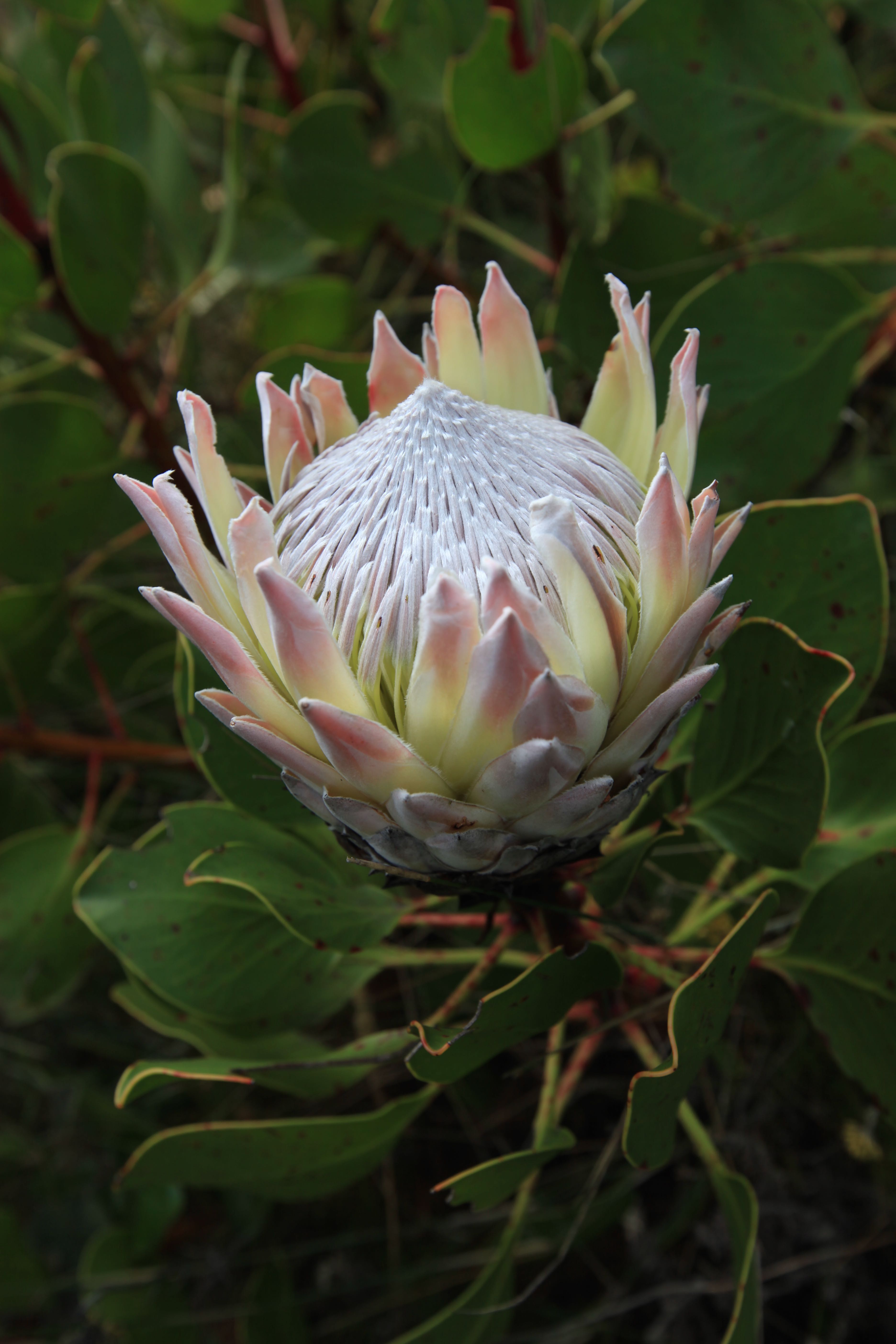
The fynbos at Silvermine is absolutely superb, particularly in spring and early summer when the reserve is aglow with bright yellow and green conebush proteas including the Sickleleaf Conebush (Leucadendron xanthoconus). Pincushions like the well-named Kreupelhout - crippled tree – (Leucospermum conocarpondendron) are widespread, while in spring and summer you’ll traverse slopes covered with white Erica mammosa and yellow-white Erica lutea.
The reserve is also rich in spring-growing orchids including the brightly coloured Satyrium coriifolium, one of the most attractive terrestrial orchids of the Cape Floral Region. There are lots of peas too including Cape Sweet Pea (Dipogon lignosus) and the purple-pink, spring flowering Keurboom, (Virgilia divaricata) also known as Cape Lilac or Blossom Tree.Table Mountain flora
The fynbos at Silvermine is absolutely superb, particularly in spring and early summer when the reserve is aglow with bright yellow and green conebush proteas including the Sickleleaf Conebush (Leucadendron xanthoconus). Pincushions like the well-named Kreupelhout - crippled tree – (Leucospermum conocarpondendron) are widespread, while in spring and summer you’ll traverse slopes covered with white Erica mammosa and yellow-white Erica lutea.
The reserve is also rich in spring-growing orchids including the brightly coloured Satyrium coriifolium, one of the most attractive terrestrial orchids of the Cape Floral Region. There are lots of peas too including Cape Sweet Pea (Dipogon lignosus) and the purple-pink, spring flowering Keurboom, (Virgilia divaricata) also known as Cape Lilac or Blossom Tree.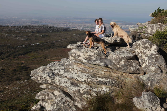
Getting there
Drive up Ou Kaapse Weg and turn off at the sign to the main Silvermine gate (Gate 1). Pay your entrance or show your Wild Card then drive up to the main car park near the dam, where there are flower identification and trail information boards and toilets.
Trail description
Although you can head up the main path from this car park - following signs to Elephant’s Eye Cave - it’s more fun to take the narrow path from the car park signposted to ‘The Crags’. The trail climbs gradually through fynbos to the ridgeline where it swings left on the ‘Climber’s Path’ along the top of the Silvermine cliffs. The route is mainly on a sandy path, with a few rocky sections, and is a little longer and more taxing than the ‘normal’ route but the stupendous views more than compensate.
Peregrine Falcons nest in the sheer cliffs below you – which are also home to some of the Cape’s best, bolted rock climbing routes. You’ll often spy King Protea (Protea cynaroides) along this path along with pelargonium, daisies and irises. The trail descends and crosses another jeep track (turn right here if you want to detour to Elephant’s Eye cave) then continues up through wonderful patches of luminous conebushes until it rejoins the main jeep track, climbing gently up the hill through spectacular stands of protea.
After about 10 minutes on the gravel road, you’ll see a footpath off to the left – indicated by a post with yellow boot print and letters ‘HT’. This is the dramatic Amphitheatre Path, which skirts around the top of the steep slopes that fall away towards the dam. The undulating trail winds through colourful and aromatic fynbos, offering great views of the dam and Ou Kaapse Weg snaking through the gap in the mountains to the south, then climbs slightly onto a rocky ridge from which there are stunning views of the South Peninsula - False Bay and over to Noordhoek Beach, Kommetjie and the Atlantic Ocean. From there it’s a 20-minute loop to the dam where, if you’re brave, you can have a dip before crossing over the dam wall back to the car.
In a nutshell
-
Start: Silvermine Gate 1, off Ou Kaapse Weg
-
Distance: 5.6km
-
Time: 2.5 hours
-
Difficulty: Moderately easy
-
Suitable for kids: yes
-
Exposure: Full sun
-
Water: Only at the dam
-
Dogs: Yes, with My Activity Permit for dog walkers
-
Entry fee: Small entrance fee payable at the gate, currently R35 per adult, R15 per child. Free for Wild Card, My Green Card and for dog walkers with My Activity Card..
-
Gate times: 07.00-19.00 in summer, 08.00-18.00 in winter (May to August). Last entry is one hour before closing time.
-
Tip: It’s well worth visiting the little info centre opposite the main gate, where a good selection of the flowers that bloom that month are displayed.
Best hiking map: Slingsby’s map of Silvermine & Hout Bay
Elsie’s Peak
With outstanding 360-degree vistas, gorgeous fynbos and the possibility of sighting whales and dolphins in False Bay this easy, dog-friendly walk up the distinctive little peak between Fish Hoek and Glencairn is one of the best reward-for-effort hikes on the Peninsula. The trail is particularly outstanding in spring when the flowers are at their best. Since it’s only half an hour from the summit back to your car, it makes an excellent sundowner walk.
Getting there
You can climb the peak from Golconda Road, just off the Glencairn Expressway, or from Fish Hoek. If the latter, either take the train and walk from Fish Hoek station or park at the bottom of Outspan Road.
Trail description
If coming from Fish Hoek, head up the Ravine Steps in the left-hand corner of the parking area. Keep going up (the way is obvious) until a T-junction then turn left on the sandy path that leads to a cairn with a board showing the ‘Circular Route’ to the left and ‘Elsie’s Peak’ to the right. Both ways lead to the summit but the best option is to keep left on the gradually inclining trail, which offers amazing views over Fish Hoek Beach, Kalk Bay Harbour, Muizenberg Beach and across False Bay to Hangklip.
In spring and early summer the yellow flowers of Grey Tree Pincushions – Kreupelhout - are magnificent. Pretty bulbs, including irises like the colourful Babiana villosa (a reference to the baboons that dig up the bulbs for food) are another treat, along with striking red, rare and endangered False Heath (Audouinia capitata), and the golden spiderhead (Serruria villosa), a Cape Peninsula endemic. The pretty, pink Peninsula silkypuff (Diastella divaricata) flowers year round on Elsie's Peak (and along the Silvermine Amphitheatre path).
At the next signboard turn right up a steep, rocky and uneven path signed to Elsie’s Peak. About 10 minutes later the path levels out again and you see the mast ahead.
Continue on past another junction (where the other half of the ‘Circular Route’ - comes in from the right) and an ugly mast, then scramble up to the beacon.
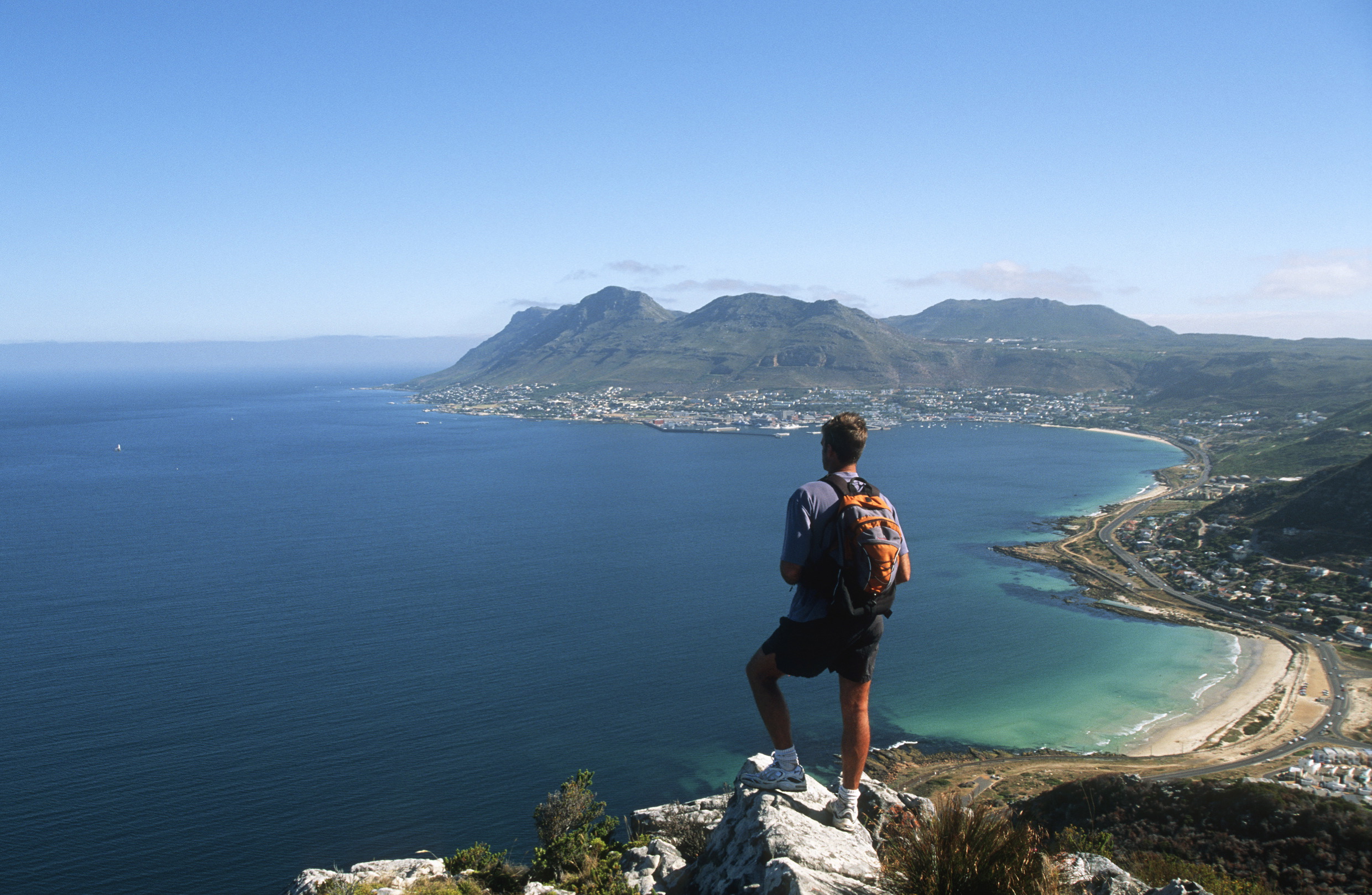
Elsie’s Peak is an important navigational beacon, used by mariners to enter False Bay safely from the time of the Portuguese explorers right up until today. The flat summit rocks are a good vantage from which to scan the ocean for boats and marine life. Great white sharks and seals frequent False Bay year round and southern right whales are often sighted in the second half of the year, particularly between September and November.
Once you’ve had tea or a sundowner and taken in the views either return the way you came, or on the alternate route. Check out the rock crevices for another central Peninsula endemic, the hardy, single stemmed Bladder-heath (Erica halicacaba) easily recognised by its unusual gooseberry-shaped flowers.
Trail description
If coming from Fish Hoek, head up the Ravine Steps in the left-hand corner of the parking area. Keep going up (the way is obvious) until a T-junction then turn left on the sandy path that leads to a cairn with a board showing the ‘Circular Route’ to the left and ‘Elsie’s Peak’ to the right. Both ways lead to the summit but the best option is to keep left on the gradually inclining trail, which offers amazing views over Fish Hoek Beach, Kalk Bay Harbour, Muizenberg Beach and across False Bay to Hangklip.
In spring and early summer the yellow flowers of Grey Tree Pincushions – Kreupelhout - are magnificent. Pretty bulbs, including irises like the colourful Babiana villosa (a reference to the baboons that dig up the bulbs for food) are another treat, along with striking red, rare and endangered False Heath (Audouinia capitata), and the golden spiderhead (Serruria villosa), a Cape Peninsula endemic. The pretty, pink Peninsula silkypuff (Diastella divaricata) flowers year round on Elsie's Peak (and along the Silvermine Amphitheatre path).
At the next signboard turn right up a steep, rocky and uneven path signed to Elsie’s Peak. About 10 minutes later the path levels out again and you see the mast ahead.
Continue on past another junction (where the other half of the ‘Circular Route’ - comes in from the right) and an ugly mast, then scramble up to the beacon.
Elsie’s Peak is an important navigational beacon, used by mariners to enter False Bay safely from the time of the Portuguese explorers right up until today. The flat summit rocks are a good vantage from which to scan the ocean for boats and marine life. Great white sharks and seals frequent False Bay year round and southern right whales are often sighted in the second half of the year, particularly between September and November.
Once you’ve had tea or a sundowner and taken in the views either return the way you came, or on the alternate route. Check out the rock crevices for another central Peninsula endemic, the hardy, single stemmed Bladder-heath (Erica halicacaba) easily recognised by its unusual gooseberry-shaped flowers.
In a nutshell
-
Start/Finish: carpark at the bottom of Outspan Road, Fish Hoek
-
Distance: 4km return (2.6km if you hike up from Golconda Road, Glencairn)
-
Duration: 2 hours
-
Difficulty: Easy
-
Suitable for kids: Yes
-
Exposure: Full sun
-
Water: None
-
Dogs: Yes, with My Activity Permit for dog walkers
Best hiking map: Slingsby’s map of Cape Point & Simonstown
The three Slingsby’s maps above are also available in digital format
Good to know:
These hikes are in Table Mountain National Park , a key part of the Cape Floral Region World Heritage Site. So take along a good guidebook such as the Quick ID Guide: Wild Flowers of the Cape Peninsula, Hugh Clarke & Corinne Merry, Struik 2019.
Even better, go for a guided walk with a fynbos fundi like Dominic Chadbon, 072 992 5636, www.thefynbosguy.com.
Shop for a cause
Shop on amazon.com | amazon.co.uk