This is an iconic trail that people book for years in advance and I can fully understand why.
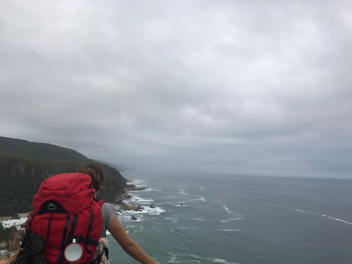
The Otter trail will quite literally and figuratively take your breath away. This is an iconic trail that people book for years in advance and I can fully understand why. The trail is 45 km over 5 days and runs along the eastern coastline from Storms River Mouth to Natures Valley in the Garden Route of South Africa. The Otter trail is rated as a moderate hike, with many steep inclines and declines through the rugged coastline and lush Afrotemperate forest. It’s a bucket list kind of hike and undoubtedly worth every single uphill.
OTTER TRAIL BOOKING INFO
-
You can book through the San Parks website
-
The hike costs R1700 in total (2021), which includes the conservation fee.
-
If you plan to hike in a large group, then booking far in advance is essential. Keep an eye out on the website as there are often spaces available for 1 or 2 people due to cancellations

Otter Trail Map
Day 1: The waterfall
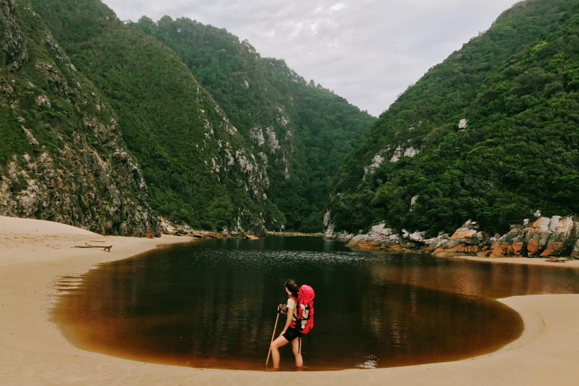
The first day of the Otter trail is 4,8 km and starts with a steep descent through the forest until you reach the coast. The trip down can be a bit of a shock if you aren’t used to carrying your backpack; by the time I reached the ocean my knees were shaking. A short walk later and you arrive at a shimmering black waterfall that plunges into the ocean. The waterfall is one of the best swimming spots that you will encounter along the Otter trail so rest your legs and take your time here. We packed an indulgent lunch for the first day which we ate at the water’s edge after a swim in the dark cool water. Don’t leave your food in the open, an unassuming seagull took off with one of our croissants never to be seen again. The first camp is set in the forest and is a short walk from a rocky beach. This is the best time to whip out that bottle of wine and the extra food you packed for the first dinner; you are going to want to lighten your bag for the next day.
Day 2: The hills
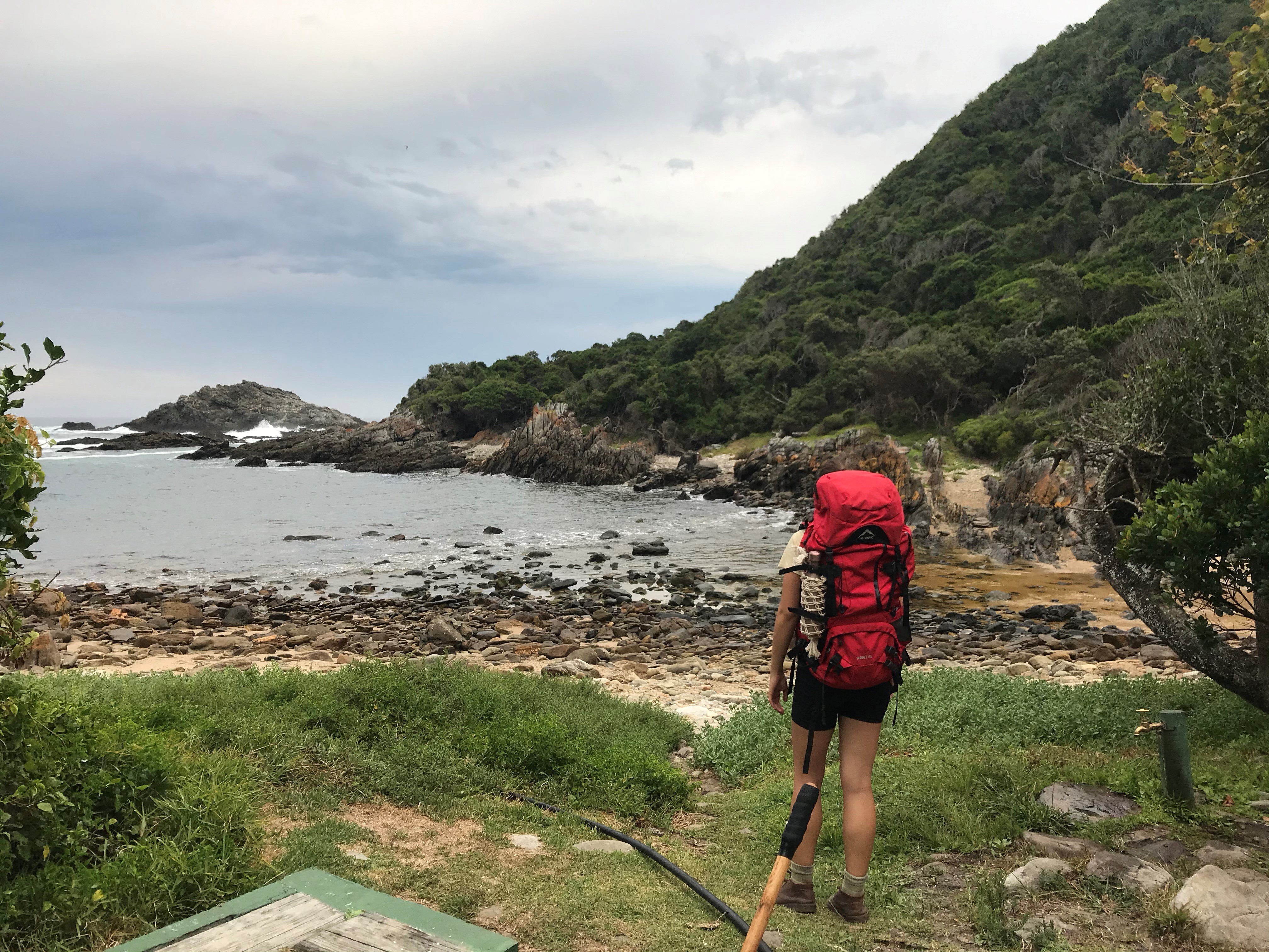
We decided to get an early start and stopped at Skilderklip viewpoint for breakfast and coffee with a sweeping coastal view. Day 2 appears to be an innocent 7,9 km walk in the park. Don’t be fooled. This day is punctuated with many steep ascents and descents through the forest. What makes this day challenging is that you may need time to become accustomed to the steep inclines and that your bag is still weighed down with food. Around the midway mark of day 2 are the Kleinbosch River crossing and the second great swim spot of the hike. The river meets the ocean and dramatically merges cliffs with overhanging forest. Take the time to explore upriver, you just might find something magical.
The next part of the hike is a series of gentle inclines and declines until you reach a crossroad. To the left is a quick detour to Blue Bay, which is worth taking the time to explore. To your right is the 150 m elevation where your legs and lungs go to catch fire. Time to whip out those wine gums.
At the top, you will stumble upon a viewpoint where you can catch your breath with a view of Blue Bay and contemplate what the hell you are doing here. Once you’ve had some water and soaked up that view, you will realize you wouldn't want to be anywhere else. From this point on its easy-going until you reach Scott Hut. This is one of the best camps on the hike with plenty to explore. Take a walk upriver and you might spot bushbuck and otter tracks in the sand.
Day 3: The coastline
The scenery just keeps getting better! On day three you move away from the hush of the forest and instead traverse 7,7 km of lush coastline until you move inland once again for two river crossings. The first big crossing of the hike is the Lottering River, which is very easy to cross. We rushed to get there in time for low tide and ended up getting to camp at 10 am. This day is easy going so don’t rush it. Take the time to swim in every rockpool and enjoy the scenery. We spent hours swimming in the river before hiking the last few meters in our kikois to Oakhurst hut.
Day 4: The Bloukrans
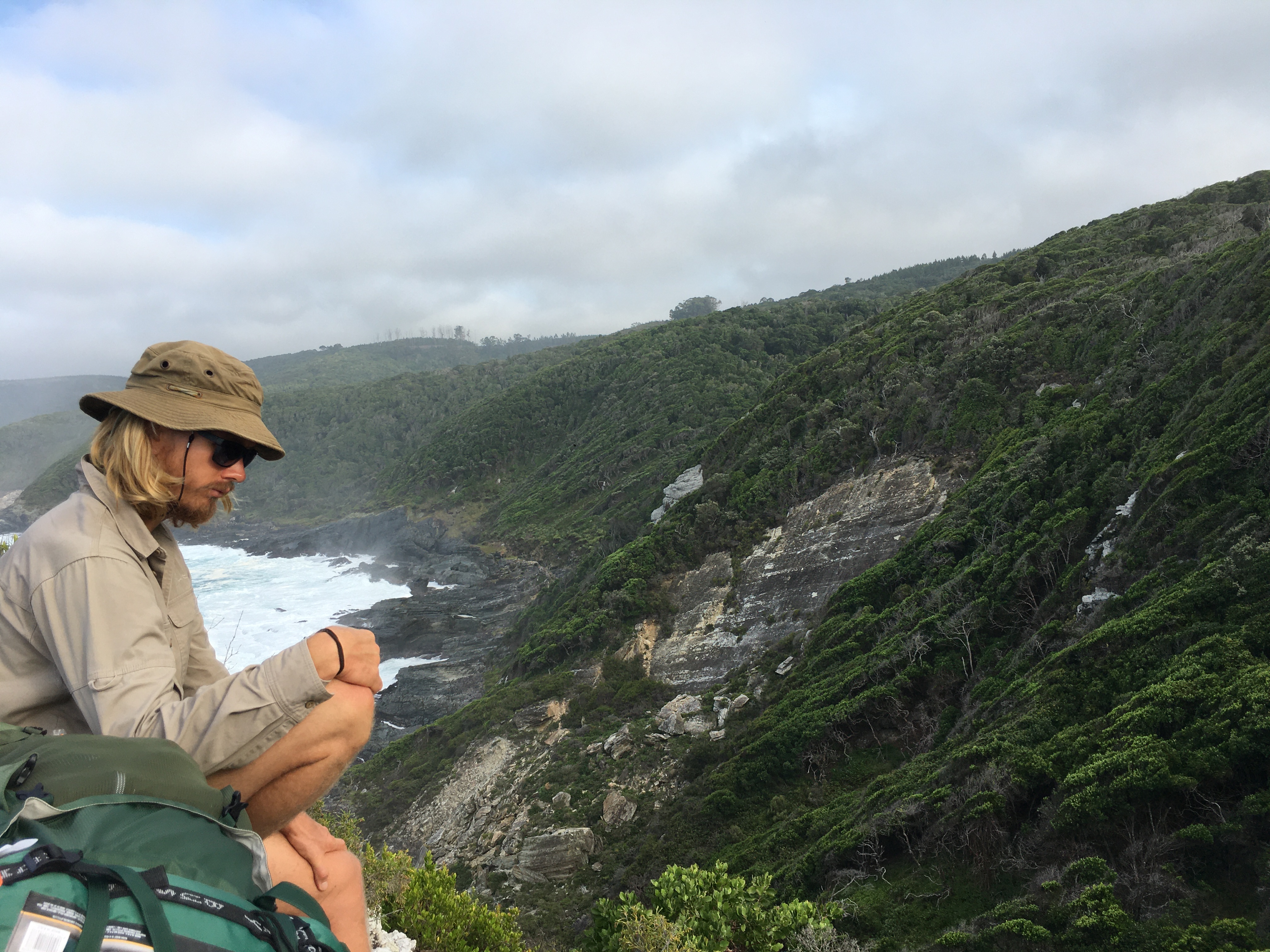
It’s time to wake up early and prepare for the Bloukrans river crossing and have more time to stop and swim along the way. Day 4 is the longest day, with 13,8 km of steep ups and downs. It takes about 5 hours hiking at a moderate pace to get to the Bloukrans River. We stopped and swam in a glassy rockpool that was teeming with anemones and brightly coloured fish. The scenery on day 4 is breathtaking, ranging from humid forests to coastline to mountain ridges of dazzling fynbos. Once you reach the Bloukrans signpost, it’s a short and steep climb down to the river. We got there with an hour to spare until low tide, dumped our packs on the beach and walked up the river to explore and swim.
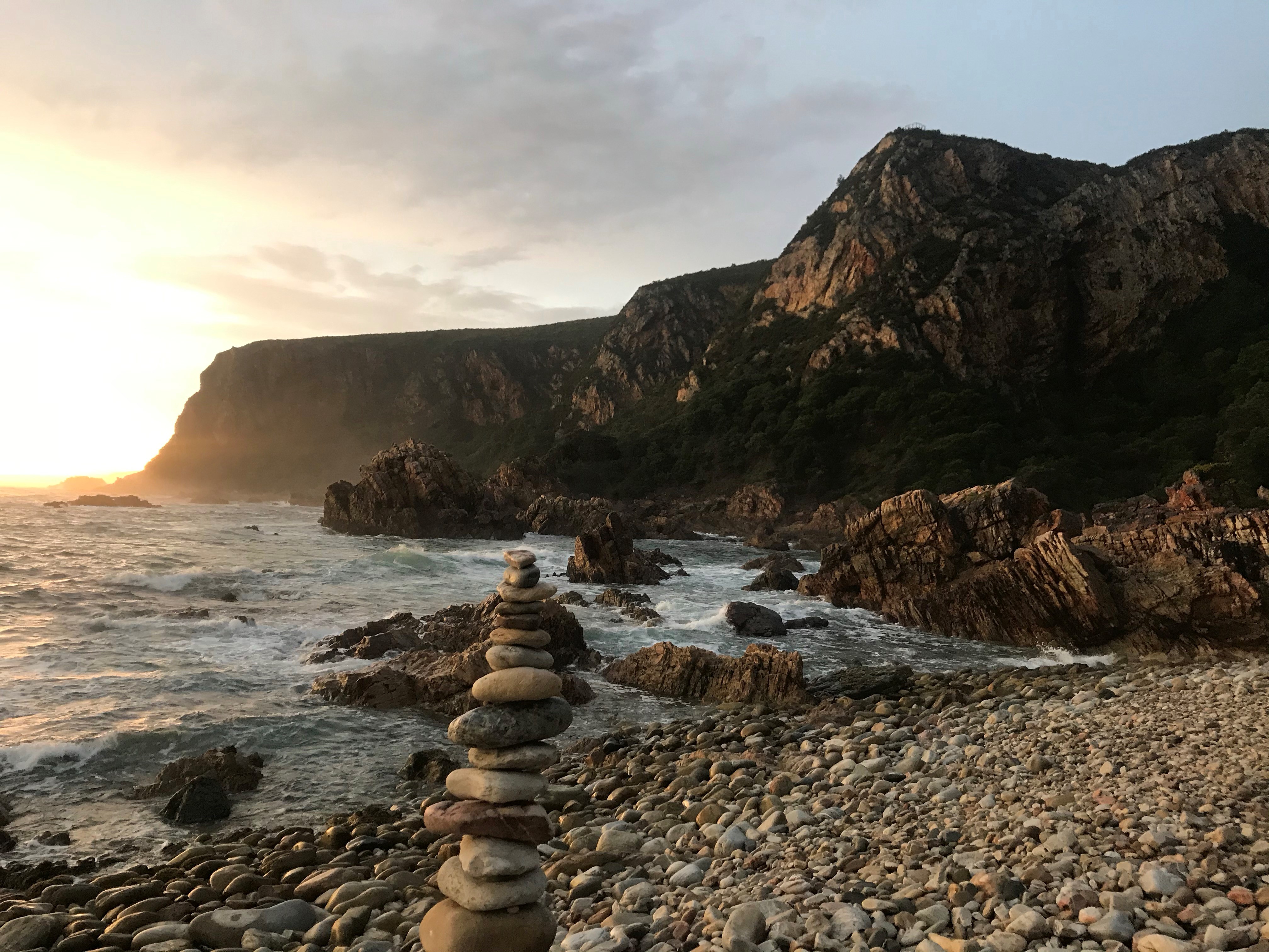
There are four different crossing routes that you can choose from, but by far the easiest is option A. The water came up to just above our waists, so we carried our backpacks over our heads as we waded across. Safely on the other side we once again dumped our packs and had another swim in the mouth with some sand sharks skimming past us. After the crossing, there will be a long staircase through the forest that will set your legs on fire, so fuel up on some snacks before heading off! When you have reached the summit of the mountain it is a stunning walk along the ridge until you spy Andre hut down below. It will be an especially beautiful sight for your wobbly legs and sore feet. This was the best camp of the hike, think pebble beaches, an outdoor shower, and a toilet with a view you won’t soon forget. On the last night of the Otter trail, our group sat on the beach in the soft rain as we watched the sun go down.
Day 5: The last day
The last day of the Otter trail starts with a short but very steep climb back up to the top of the ridge, where you will reach a viewing deck. Here you will be able to see the entire coastline you just spent four days hiking. As you turn around, you will see Robberg Island and Nature’s Valley in the distance. Day 5 is an easy 10,8 km along the fynbos ridge and through forests decked with lichen until you reach Nature’s Valley beach. After a short walk along the sand, you will see a signpost that leads you back into the Afrotemperate forest. The last 4 km of the hike are through misty forests and seem to go on forever until you reach the wooden boardwalk that signifies the last stretch to the finish. Make no mistake, as you walk through the archway your thoughts will be flooded with food. A deep sense of accomplishment will wash over you and you will leave with that tiny twinge that sits deep within, that knows you’ll be back.
SOME HARD EARNED HIKING WISDOM
Top treats:
- Pack wine gums, they will save your life when you tackle the many staircases up to the coastal ridges.
Three of my top tips:
- The shlep of taking off your hiking boots and changing into your costume to swim is 100% worth it. Take every chance you get. If we were more prepared, we would have packed a mask and snorkel.
- Applying baby powder before putting on your socks and shoes is a great way to avoid blisters. Your feet will get wet often on this trail as you will cross many rivers and have many swims!
- I recommend starting your hike early in the morning, especially in the hot and humid summer months. This time of day is the coolest and most peaceful. You might even be lucky enough to spot Bushbuck, Narina Trogon, or the Cape Clawless Otter.
Something I will never forget to pack again:
- If you are a reader then be sure to pack a book, it is worth the little bit of extra weight. There is nothing quite like lying on the beach with a good book after a long hike.
The most important message that I can leave you with is to stop and have breakfast somewhere beautiful, swim as many times along the way as you can and allow your adventurous side to awaken. This is what the Otter trail is all about. Take the time to explore and fully immerse yourself in your surroundings. Few places embrace you in the way this trail does.
Shop for a cause
Shop on amazon.com | amazon.co.uk