13 Tips for 13 Peaks
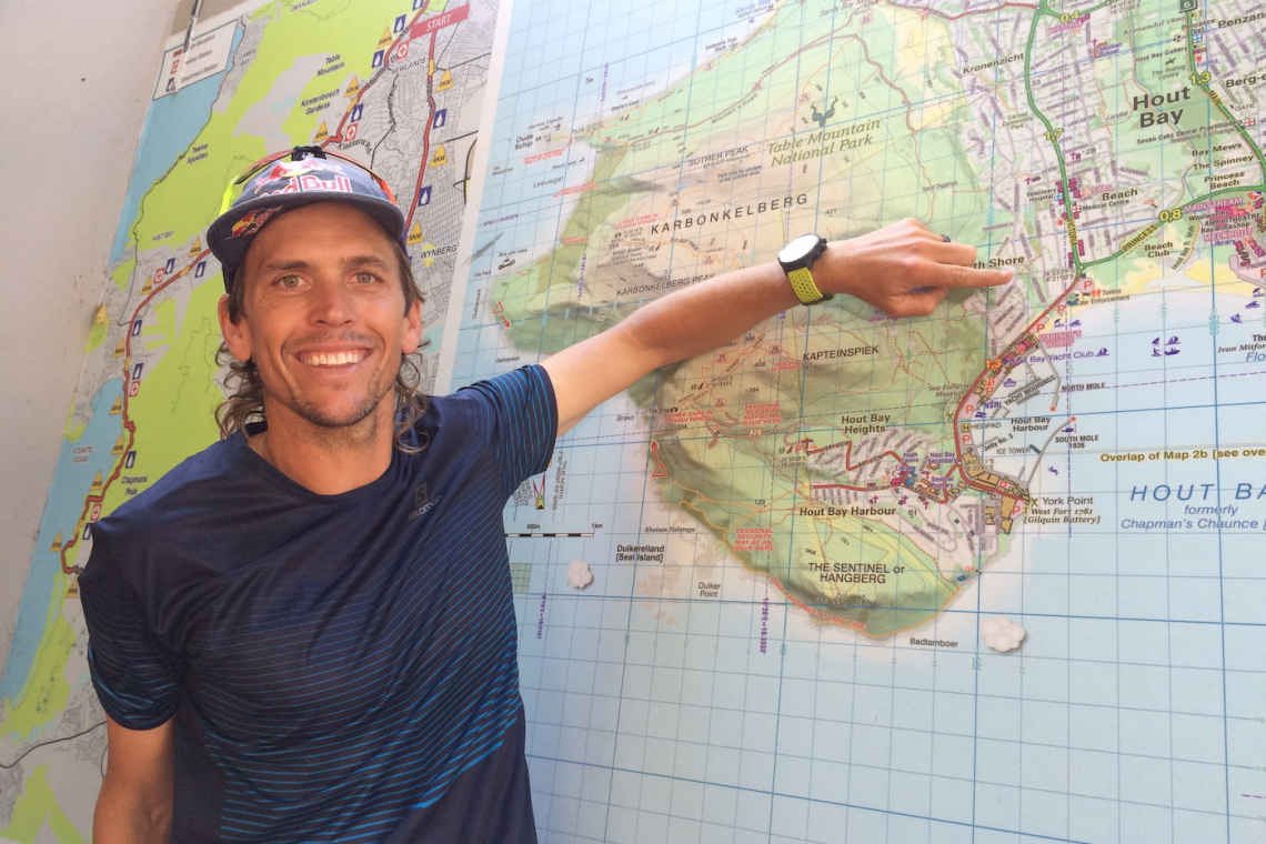
On Table Mountain most weekends, you’ll encounter trail snakes and family groups filing up hitherto obscure humps, like Judas Peak and Klaasens Kop. It’s all due to Cape Town’s trail-running superstar, Ryan Sandes. In March 2019, having won ultra-marathons around the globe, Ryan decided to create a course in his own backyard - along the lines of the UK’s famous fell-running rounds. Added to the fact that it’s a great idea anyway, with the pandemic restricting travel, it’s quickly been added to most hikers’ and trail runners’ bucket lists.

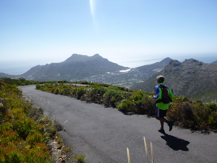
Ryan Sandes surveys his Round from Suther Peak
Starting and finishing on Signal Hill, the challenge involves ticking off 13 peaks in the Table Mountain National Park, in your own time, but a prescribed order – a distance of around 110km, depending on your route. There are three categories for those aspiring to the Wall of Honour: finishing in under 24 hours (good luck); taking less than 48 hours (you can have a break, but the clock keeps ticking); and completing the round in as many stages as you like, pausing the clock when you break, before resuming where you previously stopped. The fastest round belongs, fittingly, to Ryan himself, in a ridiculous 13h41m; whereas 12-year-old Freddie Broxis took an equally heroic 100h59m.
If you haven’t yet started, here are some tips - which won’t help you break Ryan’s record, but might make it more enjoyable and avoid some beginner’s mistakes.

The 13 Peaks route as drawn by Ryan Sandes
Planning gumpf
The dedicated 13 Peaks website is the obvious place to start, providing a gear list, safety tips and GPX track of the standard route. More traditional navigational aids include the Slingsby Maps of Table Mountain, and Silvermine & Hout Bay. If you’re planning to explore some new routes, Table Mountain Classics by Tony Lourens might save you from getting lost.
More by Matthew
How many legs and how sore?
Logistically, the simplest option is to complete the round in one push, bivvying if necessary - but most mortals will fancy a break and a bed. (Plus, in these bonkers times, there’s also curfew to consider). The only exit points accessible by car are at Tafelberg Road, anywhere between Suikerbossie and Chapman’s Peak, Ou Kaapse Weg, Constantia Nek, and Tafelberg Road again (though by then you’ve only 8km to go). Leaving the route anywhere else adds unwelcome distance and elevation gain. If you’re completing the round in two epic stages, the optimal stop is on Ou Kaapse Weg, either before or after Muizenberg Peak (approximately 60km or 70km). If doing it in three, Hout Bay (after 43km) and Constantia Nek (another 43km) make sensible breaks.
Rope in mates or stash
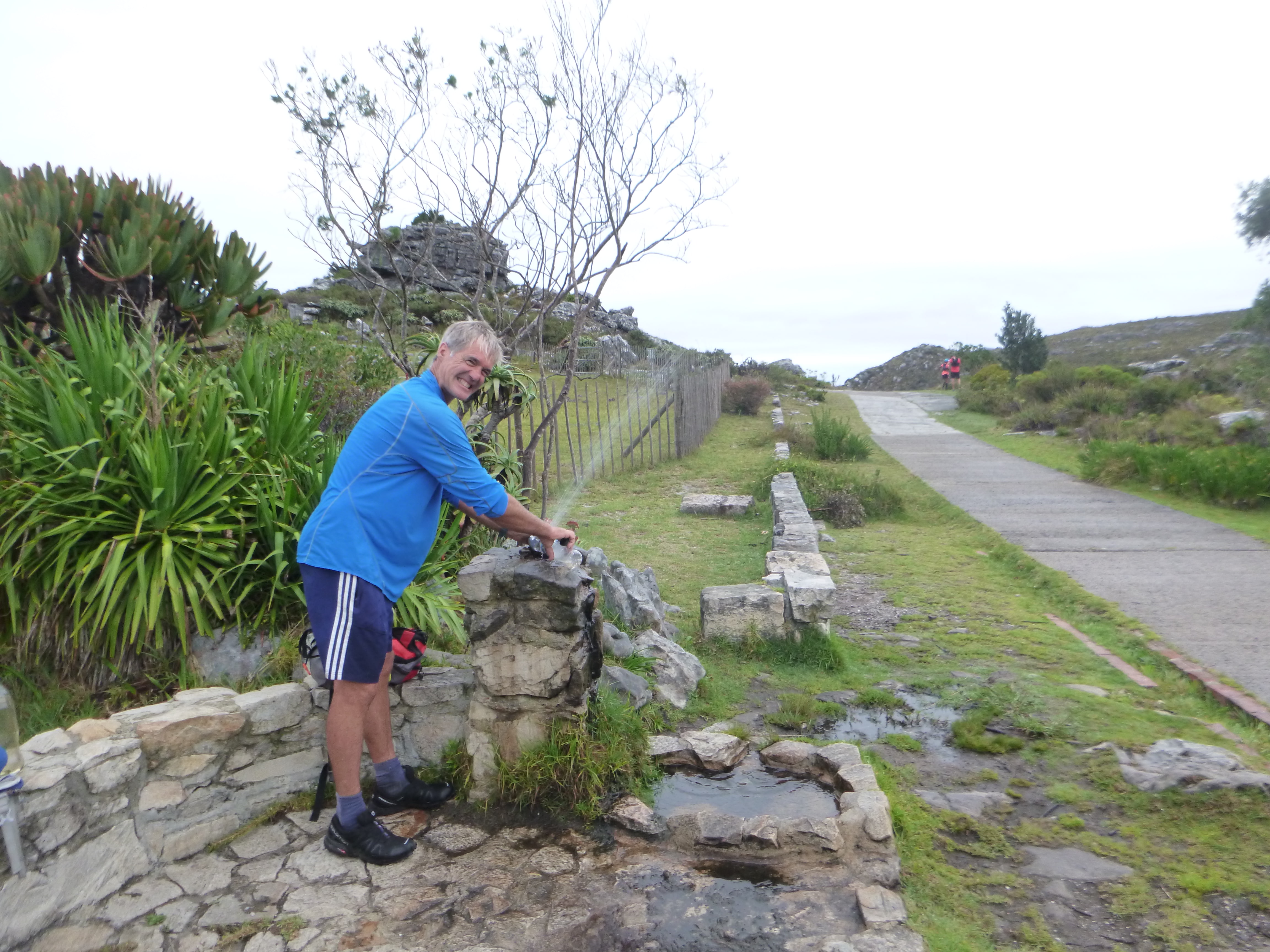
While you can probably carry sufficient snacks, you might need to consider hydration - since you won’t want more than a couple of litres sloshing about on your back. There are cafes and/or shops at the Lower Cable Station, Suikerbossie, Hout Bay and Constantia Nek, but they might not be open when you need them. Post the water crisis, the remaining public taps are at the People’s Hut, Silvermine Dam toilets and Overseer’s Cottage. And though you can normally forage some water on the mountain, it’s less reliable during summer. The ideal solution is to have your loyal batmen meet you along the route, with picnics and moral support. Otherwise, Norman No-Mates should consider pre-stashing water at strategic points, such as Suikerbossie and Silvermine 2.

Heading for Lion's Head - it's recommended you start earlier than this
Firing the starter’s pistol
You start your own 13 Peaks Challenge whenever you like, which is a conundrum. Besides security considerations (there are some spots you won’t fancy passing through in the dark), there’s also the unexpected problem of congestion. Most weekends, sunrise on the Lion’s Head will illuminate a cheery, noisy, slow-moving procession, with the bottlenecks at the chains like those on Everest’s Hillary Step. To avoid frustration, start pre-dawn, or in the afternoon, and/or on a weekday.
On Kloof Corner Ridge - the most direct way to Maclear's Beacon
Where’s the start?
As I discovered, the starting line on Signal Hill can be embarrassingly well-hidden if you haven’t been there before and it’s dark. The summit beacon is discretely placed on a small mound, some 100m NE of the carpark – along a jeep track that starts by the last hut and invariably has lake-sized puddles to ford. There are sweeping views from the beacon, though it might well be dark and you’ve probably got other things on your mind.

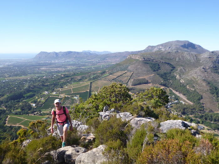
Perusing the route from Judas Peak
Getting onto the high table
Although the 13 Peaks website contains a GPX track, other than ticking off the peaks in the right order, you’re free to design your own route. Your first major choice is how to ascend Table Mountain to Maclear’s Beacon. The easiest and safest way is via Platteklip Gorge’s infernal steps. On the other hand, Kloof Corner Ridge is more interesting, direct and probably faster, though you’ll need to be comfortable with C+ grade scrambling – and your 13 Peaks Challenge isn’t the time to find out. A halfway house, located midway between the two, is India-Venster.

Next target Little Lion's Head - the fire break is the best way up from Suikerbossie
Up and over Grootkop?
Once you’ve crossed Woody Ravine on the Apostles Spine Path, your fourth target, Grootkop, rears up on the skyline - though there are still several more ravines before you’ll reach its base. Most peak-taggers will opt for an out-and-back up the standard route on its east flank. A more satisfying option, however, is to ascend the B-grade route up its north face - which is shorter in distance, offers some pleasant if bushy scrambling, and will probably take the same time. Leaving the Apostles Spine Path, follow the cairns towards the peak and cross Oudekraal Ravine, aiming for two large flattish boulders. Thereon, plentiful cairns mark the route, except when you need them. Having surprised anybody lounging on the summit, take the standard route down and stagger on towards Judas Peak.
Suther peak and the problem with taking the short-cut

The views from Noordhoek Peak make it almost worthwhile
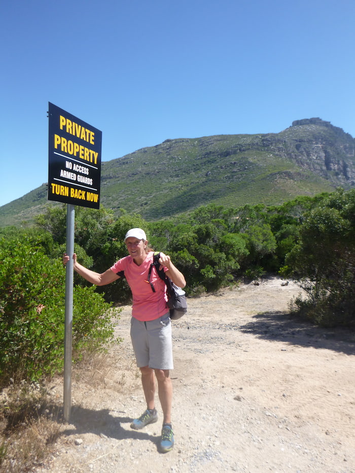
Suffer Peak
From Little Lion’s Head, Suther Peak looks tantalisingly close and there’s a fun scrambling route off the back leading almost to its base – with the snag in the ‘almost’, for the development of the Klein Leeukop private estate has made following it all the way somewhat edgy and possibly illegal. In bygone days, you could clamber over the fence via a convenient tree, but there’s now more razor wire here than around Pollsmoor. Some people claim there’s still a sneaky shortcut, but it requires inside knowledge, might have been sealed off by the time you arrive, and you might get shot. The conservative option is to retrace your steps back down via the firebreak to Victoria Road, and stick to the tar through the more welcoming Helgarda Estate.

Wondering why we came to Muizenberg Peak
The mystery of Muizenberg
Similarly, when you’ve reached Noordhoek Peak, Constantiaberg looks tantalisingly close - just over two kilometres away, along the spectacular Skyline Path. But you’re not going there next. No, instead you must descend to Silvermine, cross Ou Kaapse Weg and stomp up Muizenberg Peak, adding some 20km to the challenge. If you’re not in a hurry, consider taking the loop from Silvermine 2 via Higher Steenberg Peak (which is 30m higher than Muizenberg Peak, but for some reason got cold-shouldered) – though this will add significant elevation gain and is much more rugged than simply following the jeep track. As you’ve gathered, this is not a tip, just a whinge. But, hey, this is Ryan’s Round and we’re always free to create our own.

The summit of Constantiaberg, which is often cloaked in cloud
Mast in the mist
You might get panoramic views on Constantiaberg, but you probably won’t – for it regularly has a cloud squatting on it, even when the rest of the peninsula is clear. Though the summit beacon is only a few hundred metres from the mast and tar road, it’s surprisingly easy to get disorientated up here in bad weather. And, if you are going to be abducted by aliens, this is where it will happen. Best have a GPS track, build cairns and/or leave a trail of breadcrumbs.
Klaasens Who?
Before the 13 Peaks Challenge, I’d never heard of Klaasens Kop - and this nodule overlooking Orange Kloof takes some finding. From Constantia Nek, the quickest route is via the steps and jeep track. On the other hand, Constantia Corner - a B-grade scramble - is more pleasing and actually shorter in distance, probably taking some 10-15 minutes longer, provided you don’t get lost. After leaving the distinctive Camel Rock, continue for 5-10 minutes across a small vlakte till you spot several faint paths on your left. Take the third and last of these, marked by the largest cairn, just before the trail starts to descend towards De Villiers Reservoir. Sporadic cairns and footfall will hopefully lead you via some head-high ravines to a tree, which you clamber through to the summit. With a bit of luck, you’ll also find your way back.

Ledges - the quickest way to Devil's Peak, provided you don't slip
The Devil’s details
After Klaasens Kop, there’s only one more peak to go, Devil’s Peak, a mere 5½ km away and 260m higher, as the crow flies – but sadly you’re not a crow. No, this is the section where records, dreams, knees and, possibly, necks can be broken. The most common way is to drop off the Back Table via Nursery Ravine and follow the Contour Path above Kirstenbosch, before slogging up Newlands Ravine. Conversely, a more daring and direct alternative is to carry on up to Maclear’s Beacon and descend to the Saddle via the classic C-grade scramble, Ledges – which significantly reduces the elevation loss and gain. This route should definitely be rehearsed beforehand and is not recommended in the dark, when wet, if at all etc. But it will save both time and your knees.

Braving strong winds to tag Devil's Peak
Home run
The fitting way to return from Devil’s Peak to Kloof Nek is along the Contour Path, ducking under overhangs, draped ferns and waterfalls – whereas the more mundane, but marginally shorter and quicker, is via Tafelberg Road. Then, on the home run from Kloof Nek along the Lion’s back, you’ll appreciate why Signal Hill qualifies as a peak. But by now, you can also start thinking about where to celebrate and post your name on the Wall of Honour.
