“There is probably no more spectacular place in the world than Cape Town and Table Mountain” Sir Edmund Hillary
Hiking on Table Mountain, one of the New 7 Wonders of Nature, is undoubtedly spectacular. But I’m often asked whether it is ‘safe’. Generally speaking, it is, provided you follow basic guidelines and know what to do in the event of an emergency. In this article, I’ve selected some of the ‘safest’ trails and given some tips on mountain safety.

View of Lions Head at sunset from Table Mountain, Shaen Adey
WHAT MAKES A TRAIL SAFER THAN OTHERS?
It’s essential to recognise that ‘safety’ covers two different aspects: safety from the physical elements and safety in minimising the crime risk.
Safety from the physical elements
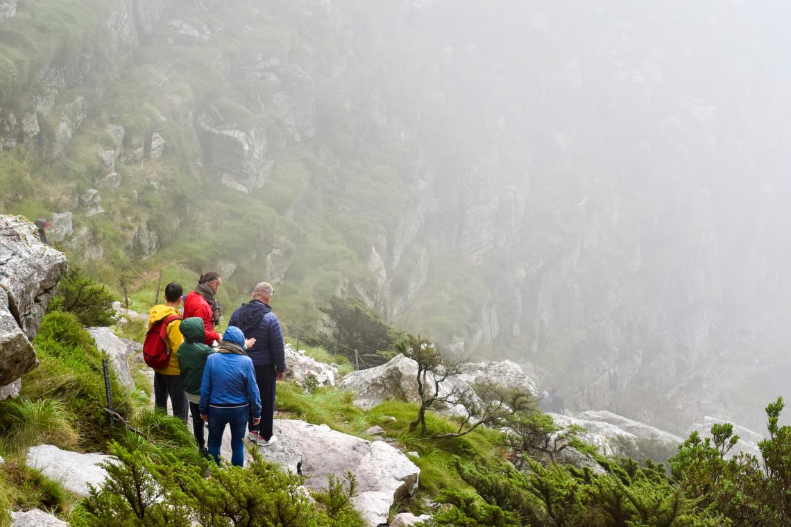
Table Mountain is a big mountain, so hiking its trails should not be underestimated. At 1086m high, the summit of Table Mountain (Maclear’s Beacon) is just 259m lower than the lofty Ben Nevis, the highest mountain in the UK! The weather on Table Mountain is unpredictable and even on the mountain’s lower slopes negotiating steep cliffs and ravines, water courses, loose rocks, tree roots and uneven paths can result in injury. Heat exhaustion, dehydration, or slipping off the path is possible. And it’s easy to get lost in the mist or because you can’t read a map properly (or haven’t brought one!!).
In the first six months of 2023, there were over 100 rescue callouts in Table Mountain National Park, mainly for people who were lost, tired, had heatstroke or dehydration, or had sustained minor injuries. Several were false alarms because hikers were overdue. If you are going to hike on Table Mountain please be prepared and follow the safety guidelines.

Table Mountain rescue, Rik de Dekker
SAFETY GUIDELINES
- Choose a route that is appropriate for the fitness and technical expertise of the group
- Stick to well-used, approved paths
- Leave details of your intended route and the time you expect to finish your hike with someone who will not be with you on the mountain. If you have to change your plan, advise that person accordingly.
- Check the weather forecast and take appropriate clothing, plenty of water, food and a small first aid kit. Don’t forget to apply sunscreen. Wear sturdy shoes or boots with a good grip. Remember that the weather can change extremely rapidly on Table Mountain, so always carry wet weather and warm gear even if it’s forecast to be sunny!
- Carry a compass and a map that shows your trail
- Pack a headlamp and spare batteries just in case you’ve underestimated how long the trail will take or there is an unexpected delay.
- Have a plan in place in case you get lost, somebody gets injured or there is an emergency.
- Carry a fully charged cellphone with the emergency numbers loaded on it. The METRO control room emergency number is 021 937 0300 – other useful numbers are given below. There is generally cellphone coverage on the edge of the plateau and on the high points on Table Mountain.

Table Mountain Summit Interpretive Trail, Fiona McIntosh
Safety from the criminal element
Although the number of crime incidents is minimal compared to the high volume of visitors to Table Mountain National Park, robberies and attacks do occur and are something that hikers must consider.
Table Mountain is an open-access, urban park with numerous trailheads and essentially free entrance, so exercise the same common sense and security precautions that you would anywhere else in the world. SANParks rangers conduct foot patrols in the park, particularly in areas with high visitor numbers and crime hotspot areas, in conjunction with Table Mountain Honorary Rangers, SAPS, City of Cape Town law enforcement officers, private security services, neighbourhood watch groups and other stakeholders. Still, it is impossible to police the whole area.

Kirstenbosch Contour path, Shaen Adey
The best ways to reduce the risk of being a victim of crime in Table Mountain National Park (TMNP) are
- Walking in groups rather than alone. Contact local hiking clubs eg Ramblers, Meridian or Hikers Network Hiking Club, the Mountain Club of South Africa, the Botanical Society or other outdoor organisations and arrange to walk with them as a member or visitor.
- Taking a guide: If you don’t want to hike in a group, consider taking an accredited guide who is current with local conditions. The Mountain Club of South Africa, 021 465 3412, holds a list of registered mountain guides.
- Hiking in the gated sections of Table Mountain Park, such as Silvermine Nature Reserve, Cape of Good Hope Reserve and the trails in Kirstenbosch National Botanical Garden. Taking the aerial cableway to the top of Table Mountain and hiking from there is also good.
- Avoiding areas of the park that are close to informal settlements, such as the Kleinplaas Dam on Redhill, above Simon’s Town and the slopes of Vlakenberg and other areas near Imizamo Yethu in Hout Bay
- Being discreet with your valuables
- Being alert and trusting your instincts. Turn around if you feel uneasy about anything.
If a criminal confronts you, don't resist. Keep calm and hand over your goods.

Table Mountain in cloud - it's easy to get lost in bad weather, Shaen Adey
Need to know: SAFETY 101
BE PREPARED
- Check the Table Mountain National Park website for safe hiking guidelines and updates
- Before you go, sign up for Safety Mountain Tracking by The Hikers Network a WhatsApp based service that tracks hikers and other mountain users on their adventures and gives instant access to assistance should they get lost or have an emergency.
- In case of an emergency, call the METRO control room at 021 937 0300. There is no charge for rescue services in South Africa, so if you are injured, lost or have any other type of emergency in Table Mountain National Park, call for help rather than trying to rescue yourself!
- Help others stay safe by sharing the METRO emergency number and promoting awareness of the #iamwildernesssafe campaign.
Updates on trail conditions and crime hotspots are often posted on the Table Mountain Watch Facebook page, so it’s worth checking out before planning your hike. (Note that a lot of other information that may not be relevant is also posted, so some sifting is required!)
EMERGENCY NUMBERS
- METRO control room 021 937 0300
- Table Mountain National Park Emergency Number 086 110 6417
- Cellphone emergency number 112: In South Africa, dialling 112 from a cellphone will connect you to the nearest emergency services. A call to 112 on a cell phone is free and is possible even if you do not have airtime
- NSRI 082911
No hike will ever be 100% ‘safe’, but if you’re worried about the possibility of crime while hiking on Table Mountain, the trails below are among the safest - and showcase some of the best scenery and flora in Table Mountain National Park.

Silvermine dam, Shaen Adey
Silvermine Dam circuit
The Silvermine section of Table Mountain National Park is a wonderfully accessible mountain venue for hikers, mountain bikers and runners (as well as one of the country’s top rock climbing venues). There are trails to suit hikers of all fitness levels – including the challenging climb to the top of Constantiaberg overlooking the reserve - but the short 1.6km stroll along the boardwalk that circumnavigates the reservoir is one of the nicest, particularly for families.
The entrance is off Ou Kaapse Weg, where, unless you have a WildCard or My Green Card, you’ll be charged a small fee. Drive up to the parking at the top and head towards the dam. The wheelchair-friendly boardwalk starts on the right-hand side of the reservoir, where there are several picnic spots and braai places. The trail then circles the dam, taking you over a little bridge and to the leafy section on the other side, where there are a couple of small grassy ‘beaches’ and shaded spots to rest. Swimming is permitted, so it’s a great outing on a hot summer’s day.
The trail continues over the dam wall back to the start, but if you want a longer hike, arrange to be picked up at the entrance to the reserve, and, instead of crossing the dam wall, follow the picturesque River Walk for 40 minutes or so down to the gate.
The reserve is open from 07.00-19.00 in summer until 18.00 in winter. The last entry is one hour before closing time.
Kirstenbosch Silvertree Trail, Contour Path near Skeleton Gorge, Shaen Adey
Silvertree Trail, Kirstenbosch National Botanical Garden
Some of the most diverse and beautiful hikes on the Cape Peninsula are in the National Botanical Garden at Kirstenbosch, on Table Mountain’s eastern flank. The moderately strenuous Silvertree Trail takes its name from the Silvertree (Leucadendron argenteum), a striking, grey protea seen along the route. It starts and ends at the garden’s Rycroft gate,
Pay your entrance fee, then head up through the beautifully laid out gardens to the Contour Path, catching your first glimpse of the trail’s namesakes. Soon after you reach the Contour path, you’ll cross the base of the wonderfully wooded Nursery Ravine, one of the popular routes up the mountain. If you’re hiking in the winter, spring or after heavy rain, magnificent waterfalls rush down this and other gullies and year-round, the rock faces are clothed with moss.
Continue around for 10 minutes to Skeleton Gorge. This is a beautiful section of the trail with gorgeous views of the botanical gardens and across the Cape Flats. Note the extensive stands of giant waboom (Protea nitida), a grey/green leaved protea that grows as big as plants get in fynbos. It was used in the past for anything from wagon parts (waboom means wagon tree) to leather-curing tannins and even ink.

Kirstenbosch Botanical Garden, Shaen Adey
The trail up Skeleton Gorge, one of the most popular trails to the top of Table Mountain, is clearly marked. This was the favoured route of Field Marshall Jan Smuts and is often referred to as the Smuts Track. There’s a commemorative plaque to Smuts at the base.
At this point, there are options. If you want a shorter walk, take the path on the right, the Yellowwood Trail, and follow the signs back to the gate. But to stay on the Silvertree Trail, follow the contour path across the stream and continue in the forest to another ravine – Window Gorge.
You will notice that many of the trees have handy little labels to help identification so stop and enjoy some of the arboreal treats, which include South Africa’s national tree, the towering Real Yellowwood (Podocarpus latifolius), the saffron-coloured bark of the Cape Saffron, (Cassine peragua) the rough, flaky bark of the Hard Pear (Olinia ventosa), the low-branching Wild Peach (Kiggelaria Africana) and the evocatively named Assegai (Curtisia dentata), which takes its common name from the African spear that was traditionally made from its hard wood.
About five minutes after passing Window Gorge, you come to a fork. Take the path to the left, which zigzags up the slopes of Fernwood Buttress. (The right-hand path will take you back into Kirstenbosch). Somewhat unexpectedly, the ‘Contour Path’ (which at this point is inappropriately named) climbs steeply up the side of a scree slope known as The Aloes for 20 minutes or so, an altitude gain of around 150m. If you’re there in mid-winter, look out for the striking red flowers of the endemic Fynbos aloe (Aloe succotrina) as you reach Dassieklip, the trail's highest point. Take care to follow the trail markers when traversing the boulder field at this point. The trail then descends equally steeply down the log steps on the other side, so take it easy, enjoying the ferns, fungi, mosses, liverworts, lichens and the delicate blue flowers and velvety leaves of the aromatic Plectranthus zuluensis.
Almost immediately after the descent, you arrive at the sign indicating the northern boundary of Kirstenbosch. Take the trail going off to the right, which follows the old ‘sleeppad’ (the path used by early settlers to drag timber down from the forest) to Lubbert’s Gift, from where you can follow the Yellowwood Trail and then signed paths back to the gate.

Table Mountain Summit Trails: upper cableway station, cafe and viewing area, Shaen Adey
Table Mountain Summit Trails
If you’re looking for safe, leisurely walks, the trails on Table Mountain’s summit plateau are hard to beat. Getting there involves either a long uphill hike or a ride in the cable car, so you can be pretty sure they’re relatively safe from a personal security point of view. That said, although the trails are relatively flat and straightforward, don’t be blasé. If the weather changes – which it often does, quickly – it’s easy to get disorientated. Also, be aware that the cable car can close unexpectedly.
Three short interpretive walks start and end at the Upper Cable Station. All are clearly signed and have interpretation boards along the way explaining what makes Table Mountain and the Cape Floral Kingdom unique. A stroll along the easy Dassie Walk will only take 15 minutes, but for spectacular views in all directions, take the Agama Walk (about 30 minutes) or the 45-minute Klipspringer Walk.
Short guided walks depart from the Twelve Apostles Terrace (below the Table Mountain Café) on the hour from 09h00 – 15h00 and are free of charge.
WARNING: Remember that the Table Mountain Cableway can close at any time due to weather conditions. Be prepared to hike down.

Table Mountain Cableway, Shaen Adey
Upper Cable Station to Maclear’s Beacon – a worthy goal for peak baggers
If the weather is good (this is definitely not a safe trail otherwise) and you’re feeling adventurous, you can hike from the Upper Cable Station to the highest point on Table Mountain, Maclear’s Beacon, a reasonably easy walk that will take about an hour each way.
From the Upper Cable Station, take the Klipspringer Walk along the plateau's edge and down a short section of rocky steps aided by poles and chains to the top of Platteklip Gorge. There’s a short section of uphill to regain the height on the other side. Then, you follow the yellow footprints across the bare rock and boardwalks of the windswept plateau to Maclear’s Beacon, which, at 1086m, is Table Mountain's true summit.From the summit, you have choices. The easiest way down is to retrace your steps, following the yellow footprints back to the Upper Cable Station (a return hike of 5.5km) and descend by cable car. Alternatively, ONLY, when there is good visibility and little wind, continue past Maclear’s Beacon to the nearby information hub (hub 3), then turn left. This path, which is marked by white footprints, swings around into the natural amphitheatre beneath Maclear’s Beacon, past the Mountain Club of South Africa’s War Memorial and the Smuts Memorial (both in the cliff band) and onto a boardwalk that heads towards the edge of the mountain. From here, a narrow, windy but obvious path hugs the cliff edge, affording spectacular views of the city bowl and the precipitous cliffs below. After two kilometres (approximately 40 minutes), the Table Edge Path links up with the main path that you were on earlier, just before it descends to the top of Platteklip Gorge.
Note that Platteklip Gorge is the quickest route down if you’re planning to descend on foot or if you are forced to walk down because the cableway has unexpectedly closed due to bad weather. Our Article Table Mountain: What you need to know to take the cableway up and hike down describes this route.
Useful resources:
Websites: Mountain Meanders is a web-based compendium of maps, written descriptions, photographs, videos and GPS tracks of walks, scrambles and easy climbs in the Western Cape – and elsewhere. It has lots of detail, including route descriptions, location, key statistics, annotated photos and maps, useful safety information here as well as list of qualified guides and useful resources here
Maps: Slingsby’s maps, are the best and are available in print and digital format
Fiona McIntosh is the author of numerous books on hiking, including Table Mountain Activity Guide and Hike Cape Town.